Welsh Highland Railway
Stop Press Page
V4.6
News (9/9/23)
Archive images updated from 30?/8/95
Welcome to the new Phase 1 page
Your webmaster has recently completed scanning all of the slide collection (all 10,000+0f them). Most of the one covering Phase 1 of the WHR project have never been published before on this website but a few may have appeared in railway magazines. In the mid 90s your webmaster was working as a journalist but the Channel Tunnel story was coming to an end and also the Llangollen Railway's extension to Carrog. Thus in 1995 when the FR bought the WHR trackbed and announced it would seek grants to reopen the line, I took an instant interest, A couple of visits in 1995 recorded some of the abandoned trackbed and several visits in 1996 as the project warmed up. In 1997 there were monthly visits to record progress up to opening.
During the construction of Phase 1, I took my father for walks from Dinas along Lon Eifion and back by bus from Caernarfon to see the progress. There were visits to Glan-y-pwll to observe the WHR test track and the Garratts. There are many shots from this period including the opening of Phase 1. Subsequently there were many visits into 1998 following the opening and photographing the interesting variations of service with both diesel and Blanche operation.
The website started about 2000 and started documenting Phase 2. This section is also incompletely covered and web pages have been lost but that is a project for another year!
This is probably the first image of the future WHR I took!
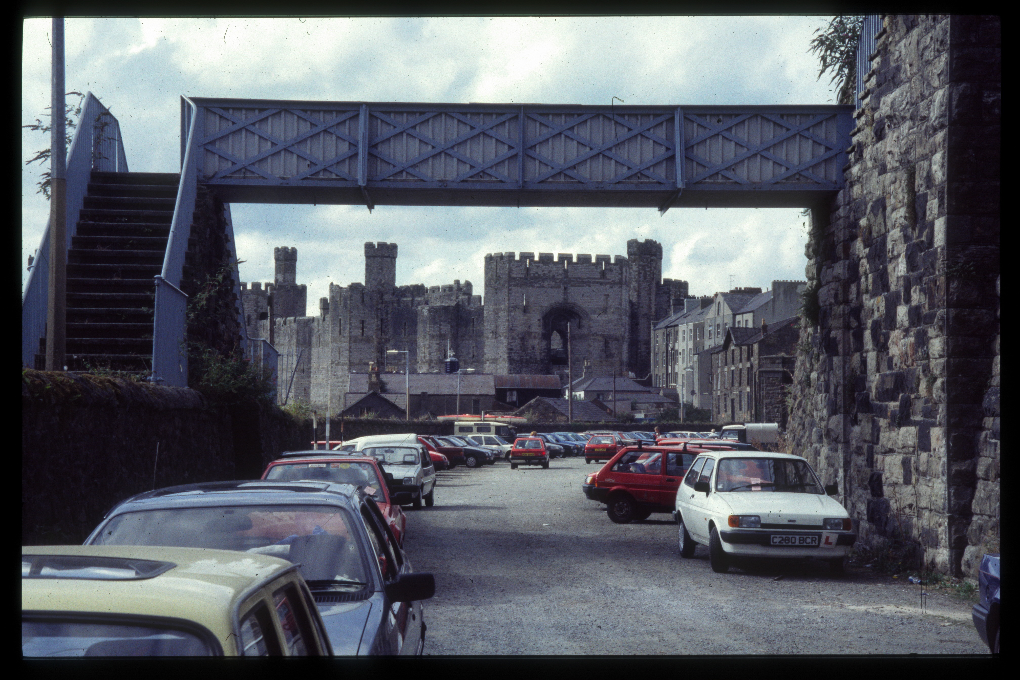
This northerly mage(14/7/95) shows Caernarfon station as a GC car park. Transfer of ownership of the Dinas-Caernarfon section was yet to happen. Image scanned from slide film by a Minolta DiMAGE Scan Dual III, Original image taken on an Sigma SA300 SLR camera copyright Barrie Hughes.
30?/8/95
A few weeks later I spent a weekend in the area and visited the FR and the untouched WHR trackbed.
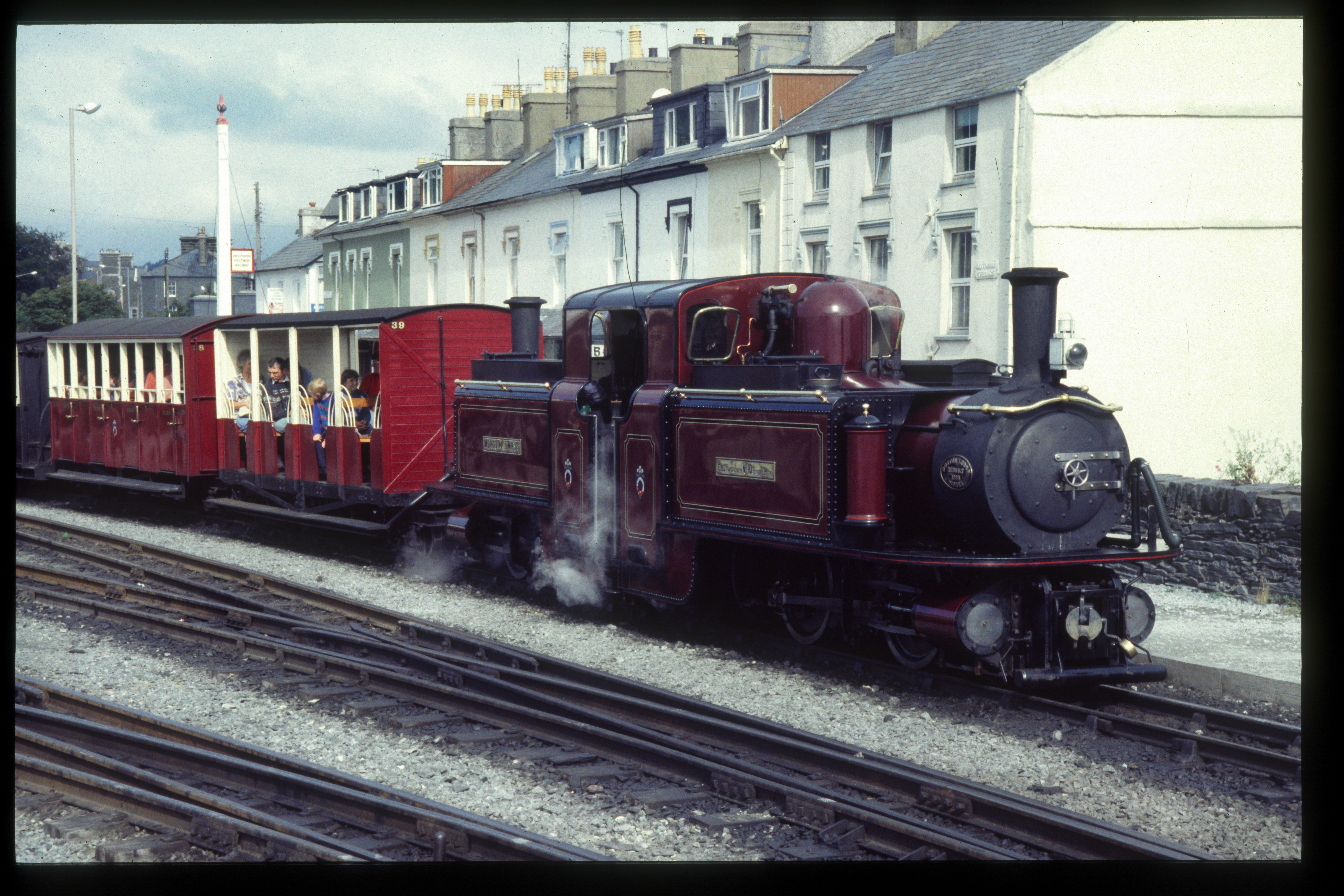
This westerly view (30?/8/95) shows Merddin Emrys departing Porthmadog with open coaches Nos.38/39 on the front of the rake. Image scanned from slide film by a Minolta DiMAGE Scan Dual III, Original image taken on an Sigma SA300 SLR camera copyright Barrie Hughes.
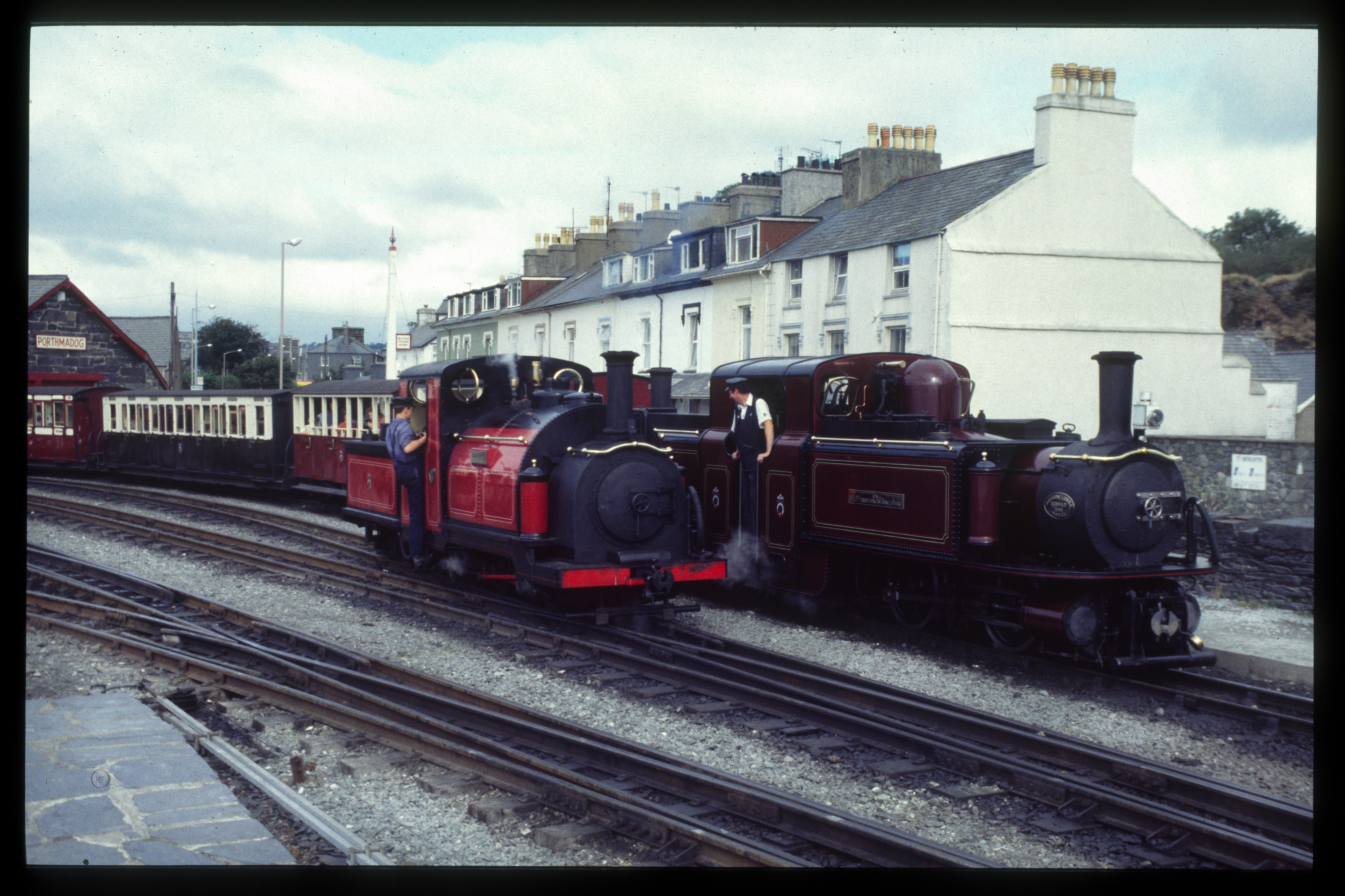
This westerly view (30?/8/95) shows Merddin Emrys departing Porthmadog with Prince shunting the yard as seen from the old ground frame. Image scanned from slide film by a Minolta DiMAGE Scan Dual III, Original image taken on an Sigma SA300 SLR camera copyright Barrie Hughes.
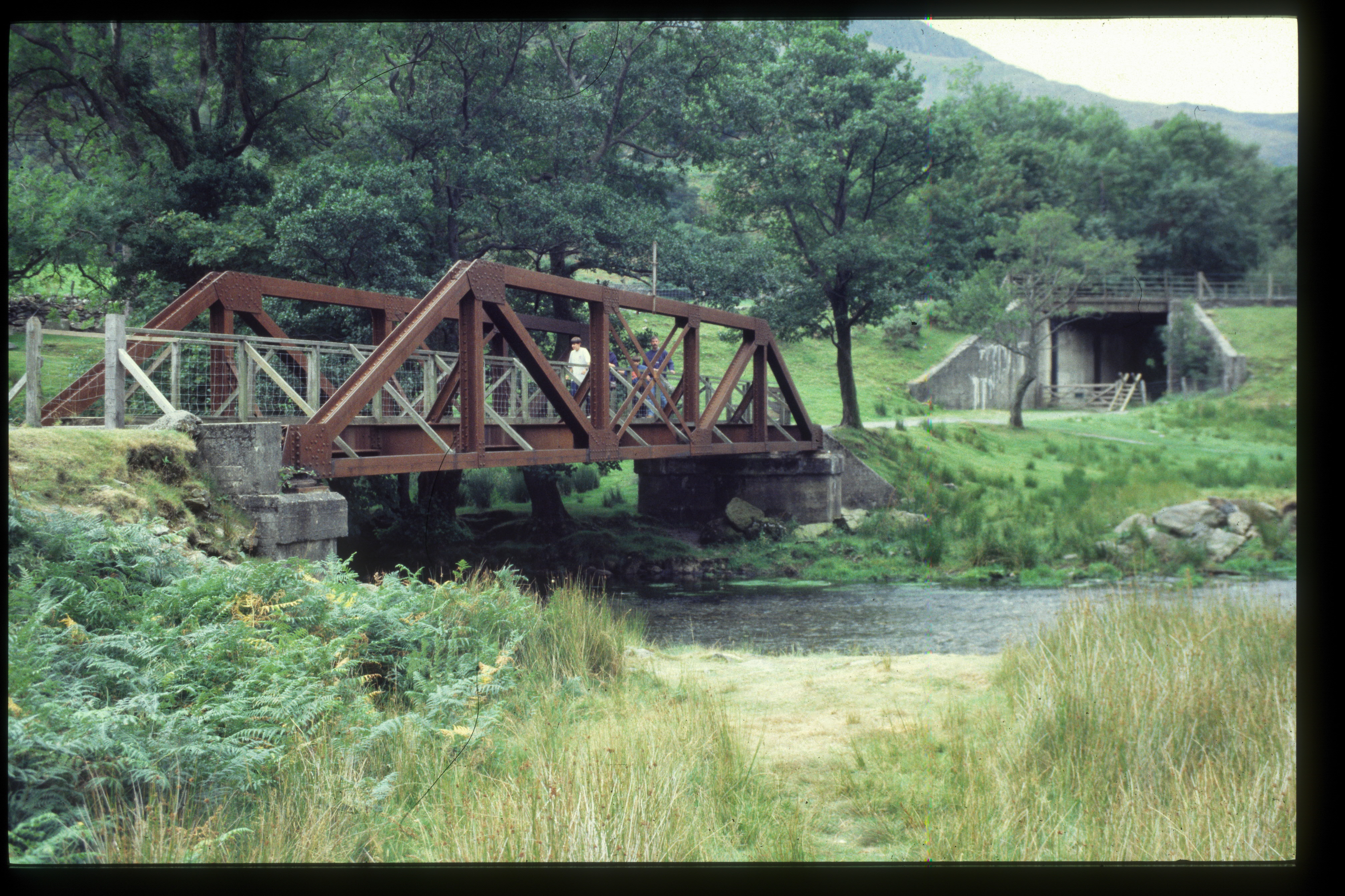
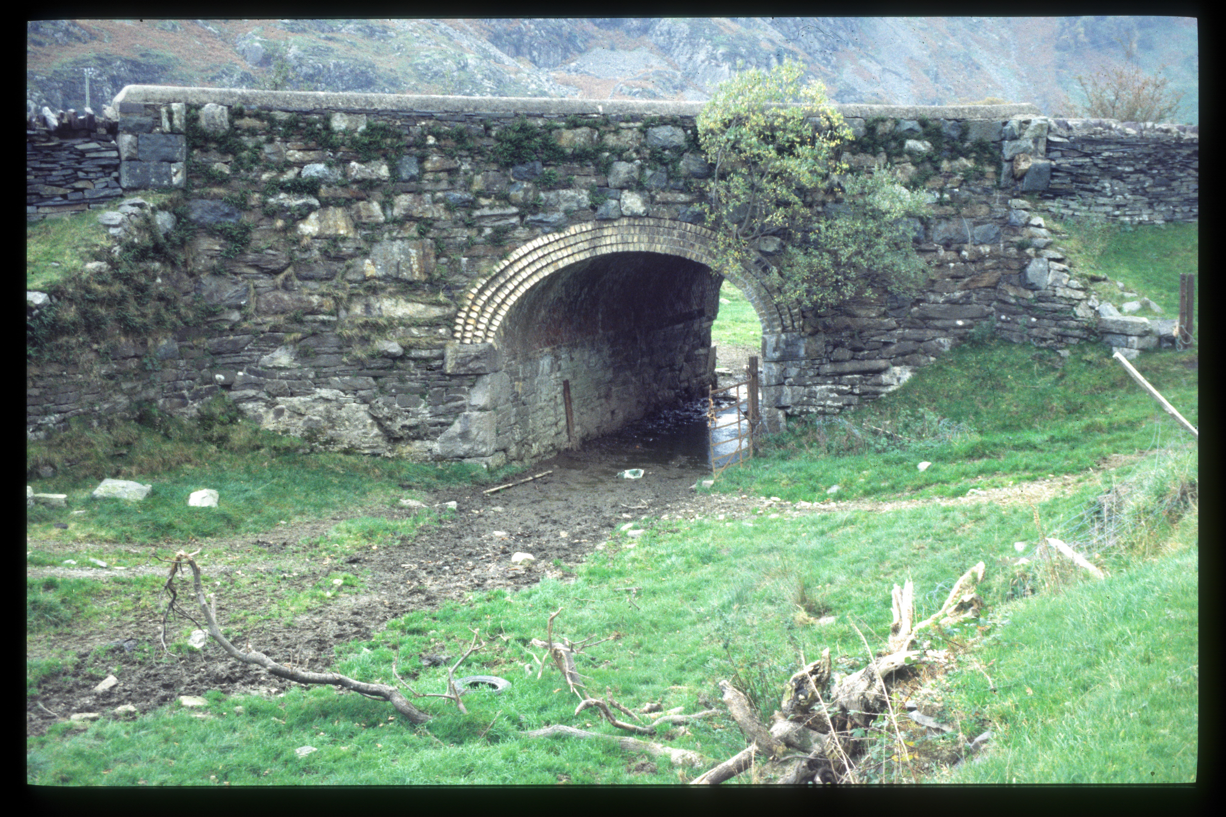
This northerly view (30?/8/95) shows Bryn-y-felin bridge with the wooden walkway erected across it by GC as seen from the PBSSR formation on the eastern bank of the Afon Glaslyn. Image scanned from slide film by a Minolta DiMAGE Scan Dual III, Original image taken on an Sigma SA300 SLR camera copyright Barrie Hughes.
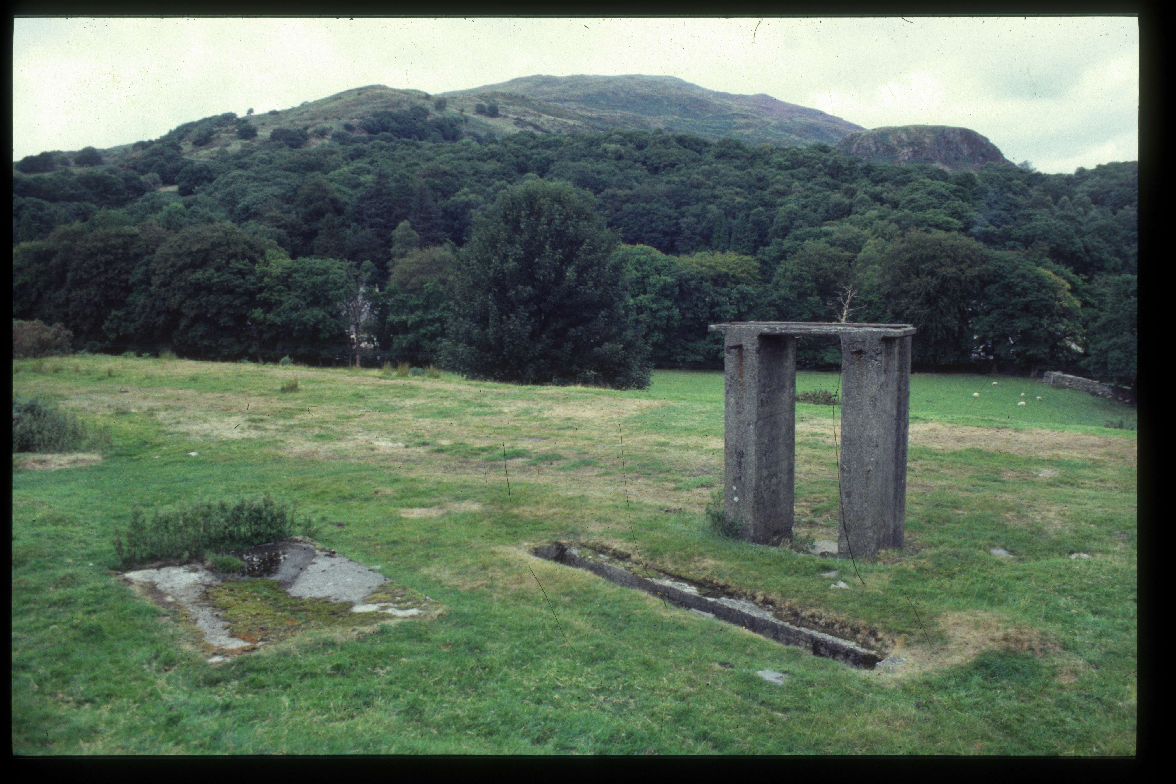
This easterly view (30?/8/95) shows the surviving features of the depot area at Beddgelert. To the left is the concrete base of the lamp hut, in the centre, the loco ash/inspection pit and to the right the concrete base of the water tower. the grass is well nibbled by sheep which allows the remaining features to stand out really well. Image scanned from slide film by a Minolta DiMAGE Scan Dual III, Original image taken on an Sigma SA300 SLR camera copyright Barrie Hughes.
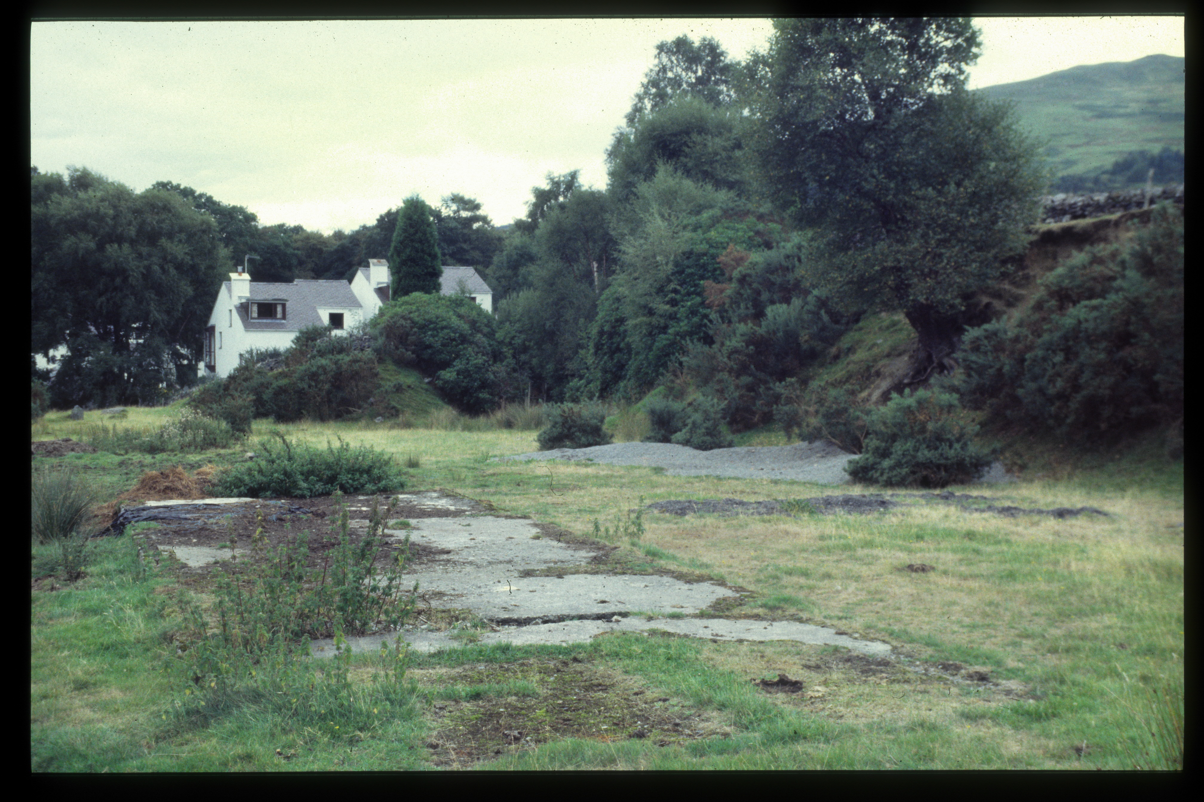
This southerly view (30?/8/95) shows the concrete base of the former station building at Beddgelert. The pile of ballast by the entrance to Goat Cutting may have been left by the aborted works of the WHHR who laid a few lengths of rail in the cutting and at Nantmor before abandoning the project. Image scanned from slide film by a Minolta DiMAGE Scan Dual III, Original image taken on an Sigma SA300 SLR camera copyright Barrie Hughes.
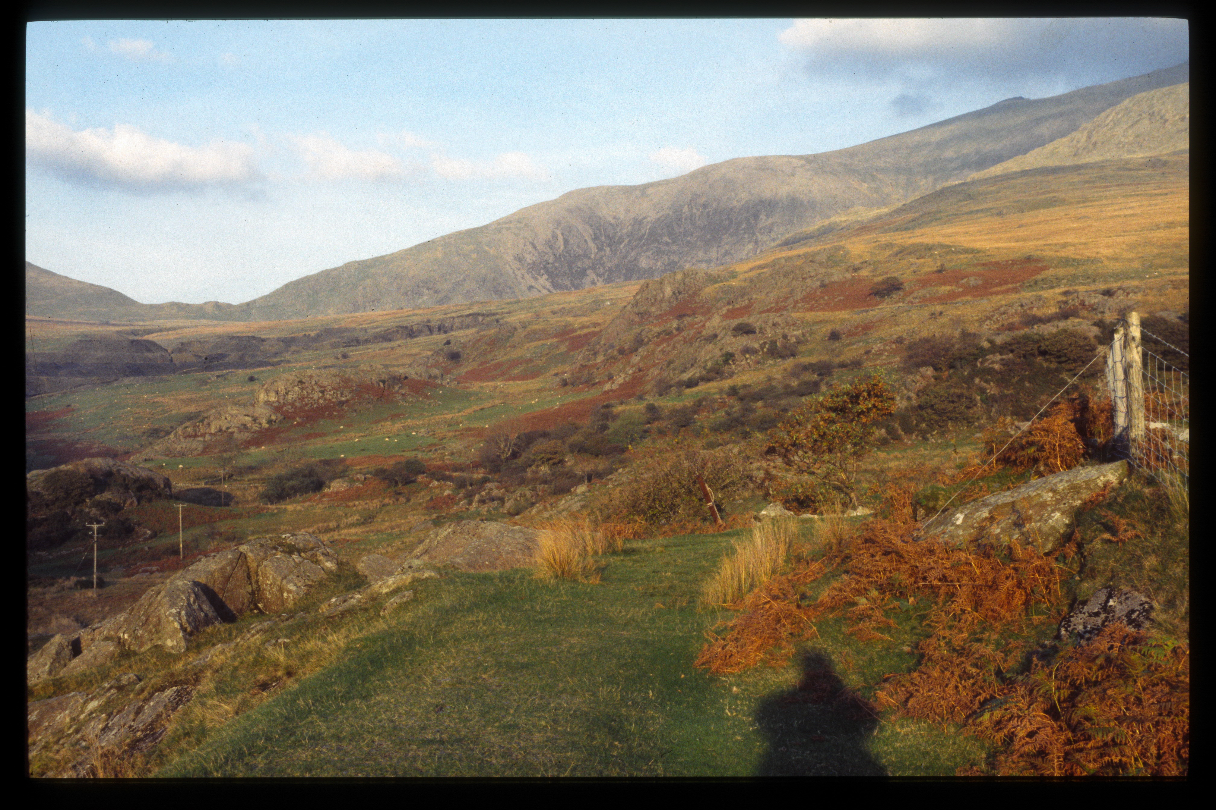
This southerly view (30?/8/95) shows the Summit Cutting south from Pitt's Head bridge. Image scanned from slide film by a Minolta DiMAGE Scan Dual III, Original image taken on an Sigma SA300 SLR camera copyright Barrie Hughes.
This northerly view (30?/8/95) shows the vacant trackbed north of Pitt's head bridge with Rhyd Ddu station is the distance. Pitt's Head Halt used to lie where the wider section of grassy formation can be seen. Image scanned from slide film by a Minolta DiMAGE Scan Dual III, Original image taken on an Sigma SA300 SLR camera copyright Barrie Hughes.
This northerly view (30?/8/95) shows the trackbed converted into a car park at the north end of the Rhyd Ddu station site. The toilet block is believed to be on the foundation of the original station building. The car park was labelled 'No Overnight Parking'. Image scanned from slide film by a Minolta DiMAGE Scan Dual III, Original image taken on an Sigma SA300 SLR camera copyright Barrie Hughes.
This southerly view (30?/8/95) shows the shelf in Pas-y-nant Gorge and Plas-y-nant bridge. A local resident was clearly using the trackbed and rail bridge for access at this time and had erected new fencing. Image scanned from slide film by a Minolta DiMAGE Scan Dual III, Original image taken on an Sigma SA300 SLR camera copyright Barrie Hughes.
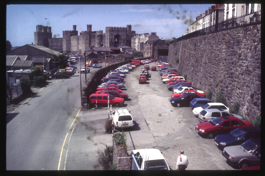
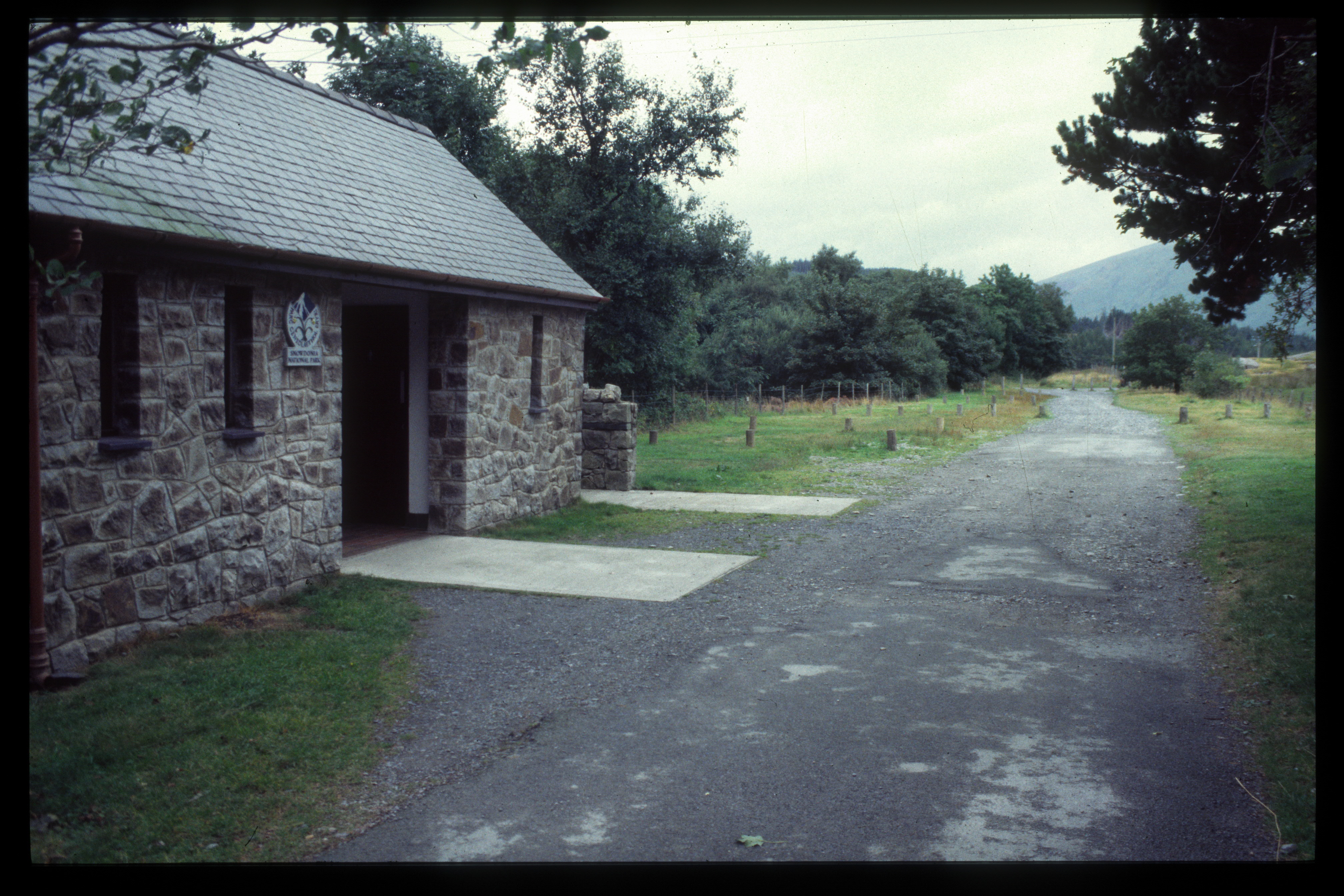
This southerly view (30?/8/95) shows the site of the future Caernarfon Station as viewed from the station footbridge. What appears to be a level crossing gate at the south end of the car park marks the start of the Lon Efion long distance footpath/cycleway on the former Bangor-Afonwen branch line. Image scanned from slide film by a Minolta DiMAGE Scan Dual III, Original image taken on an Sigma SA300 SLR camera copyright Barrie Hughes.
This northerly view (30?/8/95) shows the trackbed converted into a car park at the north end of the Caernarfon station site. The station footbridge frames Caernarfon Castle. Image scanned from slide film by a Minolta DiMAGE Scan Dual III, Original image taken on an Sigma SA300 SLR camera copyright Barrie Hughes.
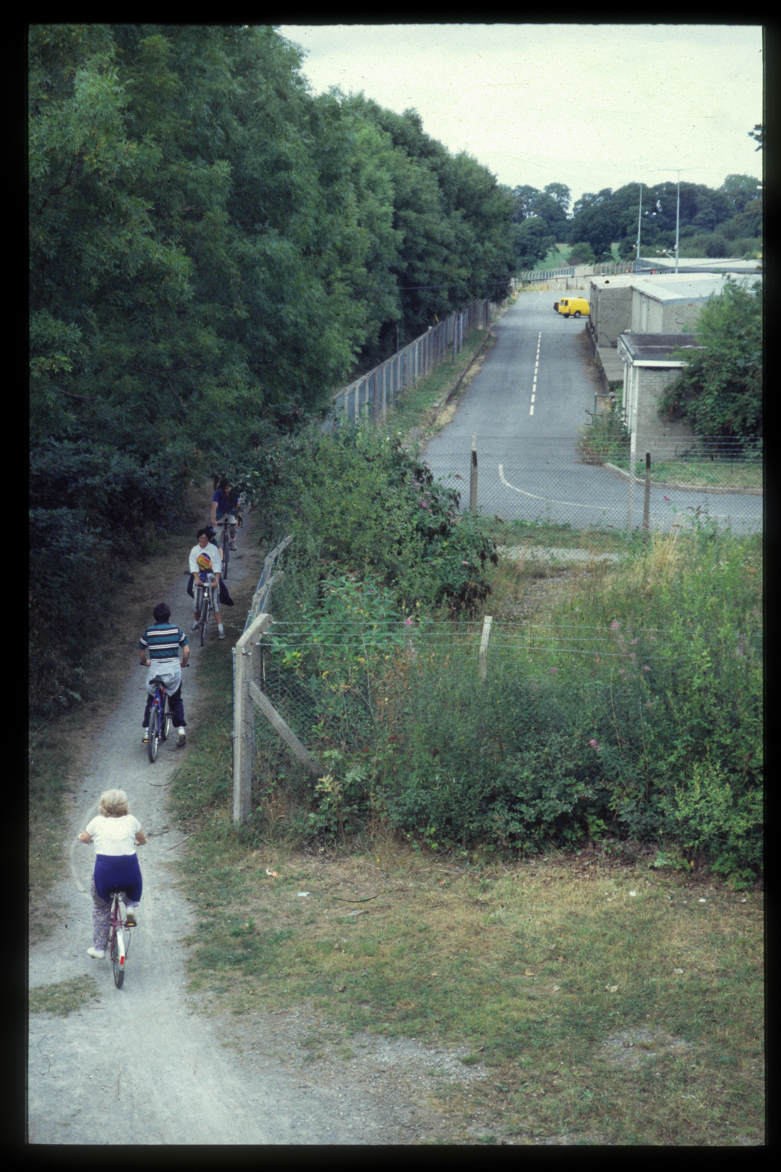
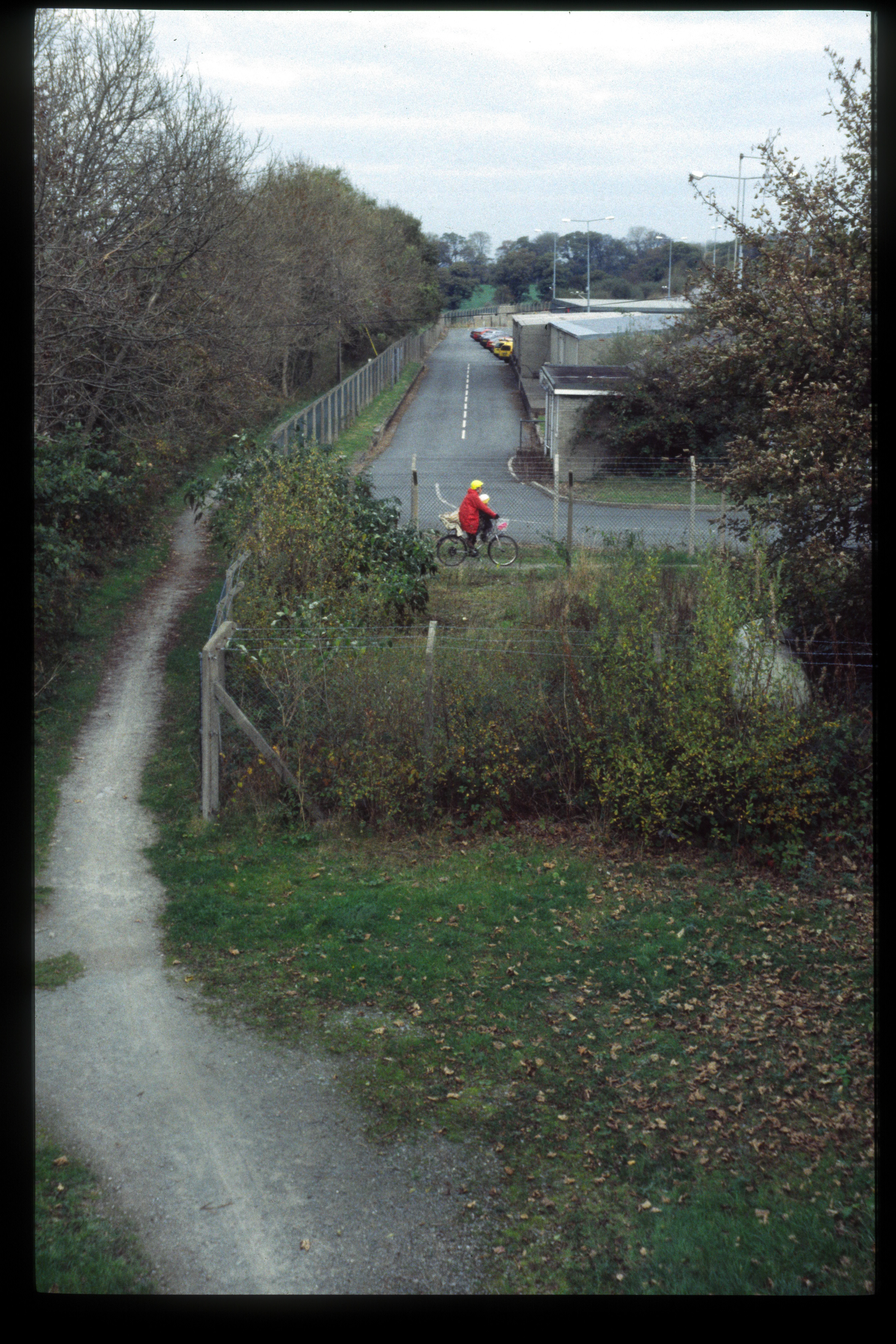
This northerly view (30?/8/95) shows a group of cyclists making use of the trackbed converted into the Lon Eifion footpath/cycleway at the site of Dinas station. The old BR platforms can be seen with a roadway between then and, on the right, an extension to the WHR station building. Image scanned from slide film by a Minolta DiMAGE Scan Dual III, Original image taken on an Sigma SA300 SLR camera copyright Barrie Hughes.
6?/11/95
We went for a walk along the trackbed north from Rhyd Ddu to the Afon Treweunydd Viaduct and then visited several other features of note along the railway before construction touched them.
This easterly view (6?/11/95) shows the trackbed just north of Rhyd Ddu as it enters the Ffridd Isaf curves. The impressions of sleepers can still be seen in the grass with Snowdon Summit in the background. Image scanned from slide film by a Minolta DiMAGE Scan Dual III, Original image taken on an Sigma SA300 SLR camera copyright Barrie Hughes.
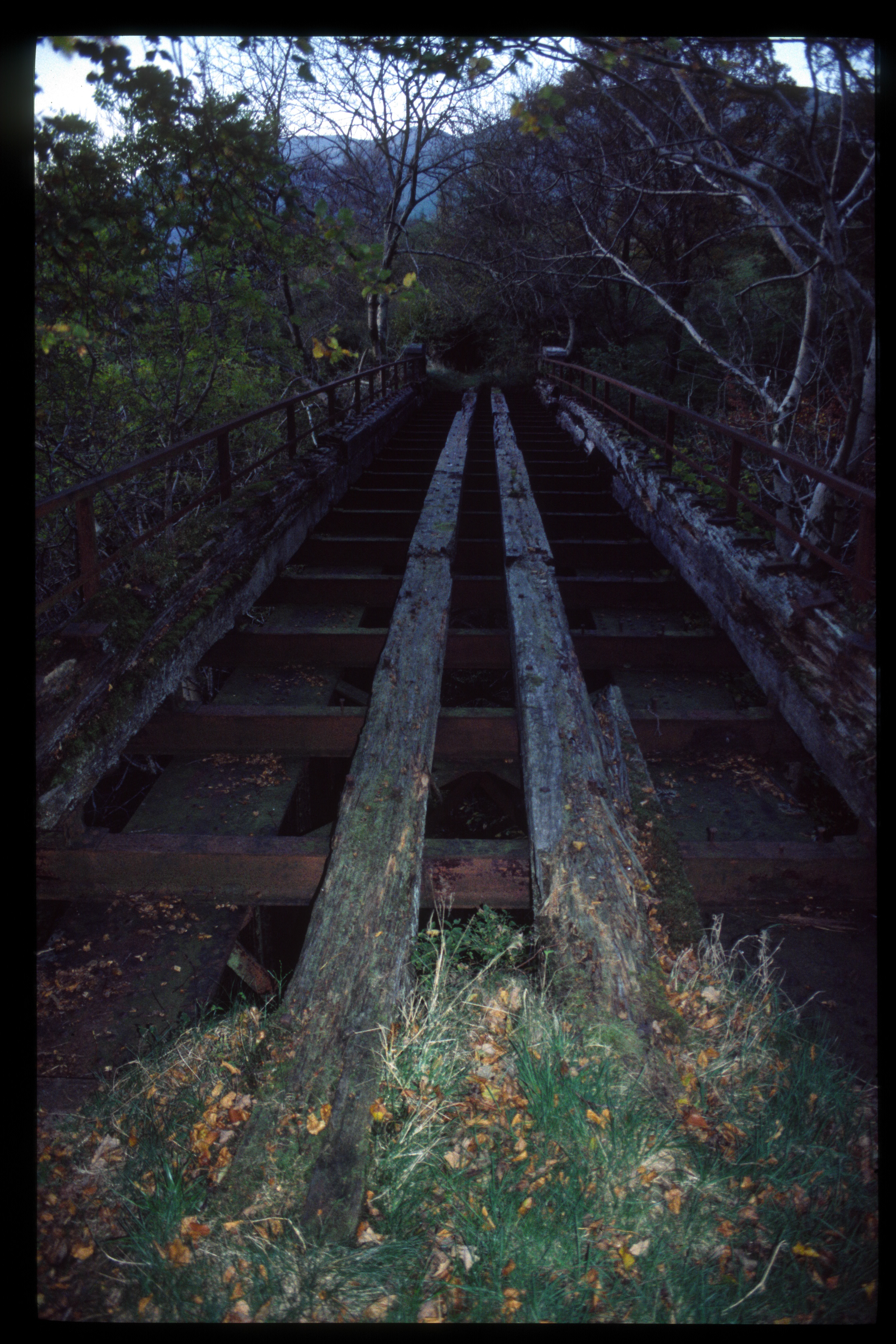
This northerly view (6?/11/95) shows the decayed state of the Afon Treweunydd Viaduct. The way beams were rotted and slimy so no attempt was made to cross the structure. Image scanned from slide film by a Minolta DiMAGE Scan Dual III, Original image taken on an Sigma SA300 SLR camera copyright Barrie Hughes.
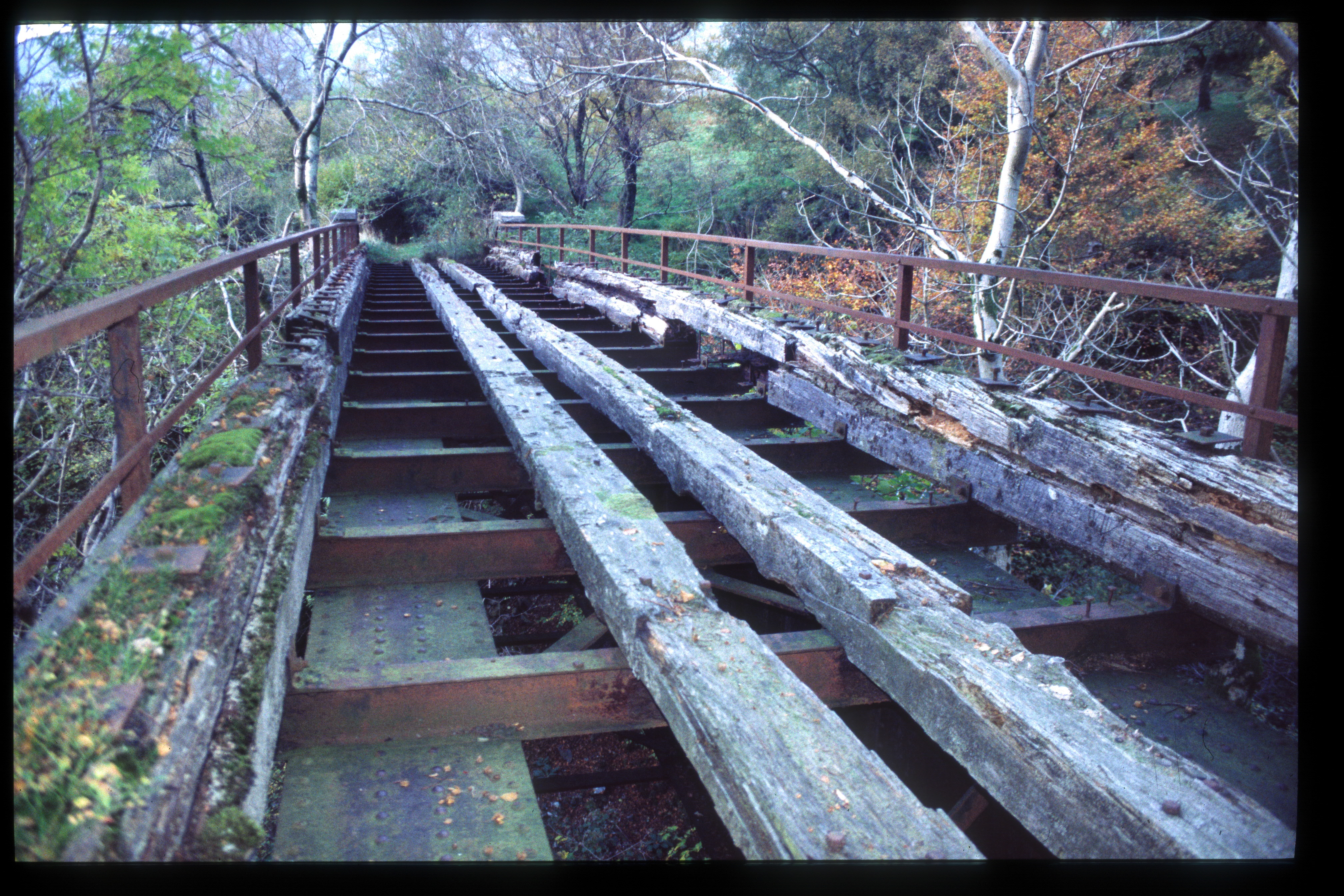
This northerly view (6?/11/95) shows the decayed state of the Afon Treweunydd Viaduct way beams. Image scanned from slide film by a Minolta DiMAGE Scan Dual III, Original image taken on an Sigma SA300 SLR camera copyright Barrie Hughes.
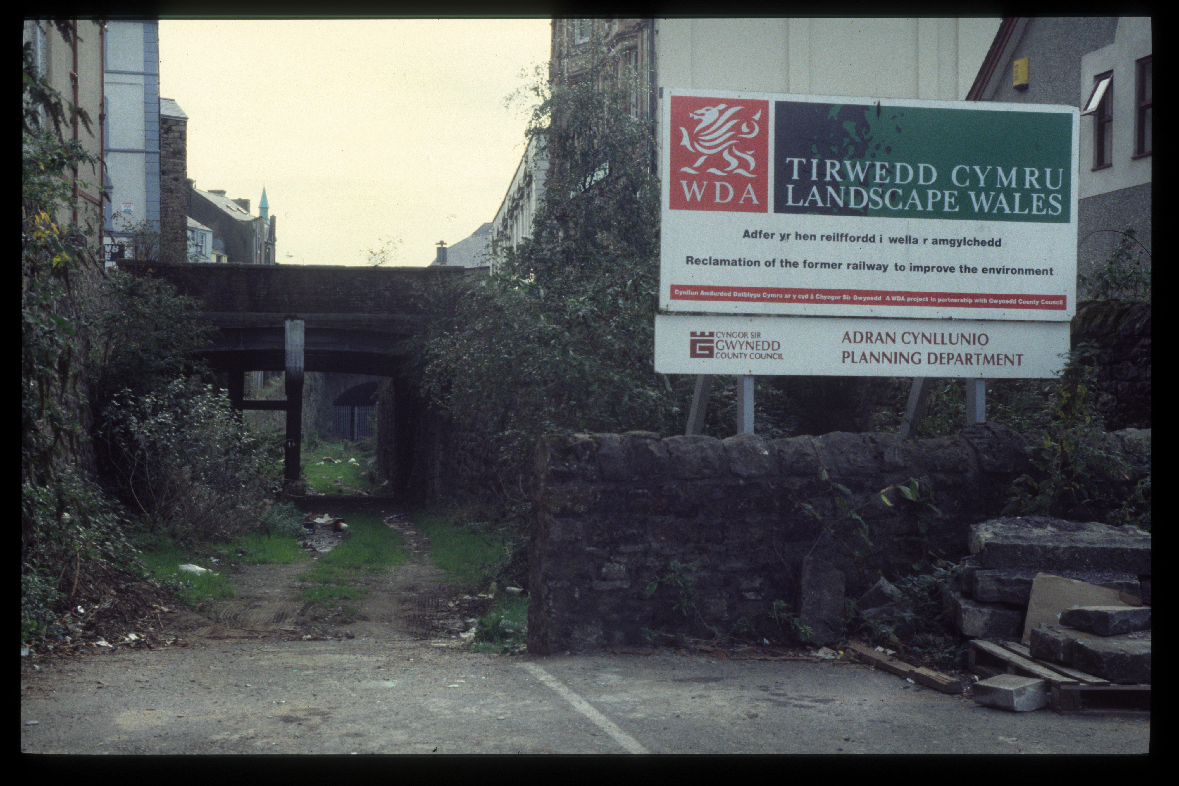
This westerly view (6?/11/95) shows the redevelopment of the Caernarfon Cross Town Link as a road by the Welsh Development Agency. This route would later become the tunnel that emerges by Caernarfon station. Image scanned from slide film by a Minolta DiMAGE Scan Dual III, Original image taken on an Sigma SA300 SLR camera copyright Barrie Hughes.
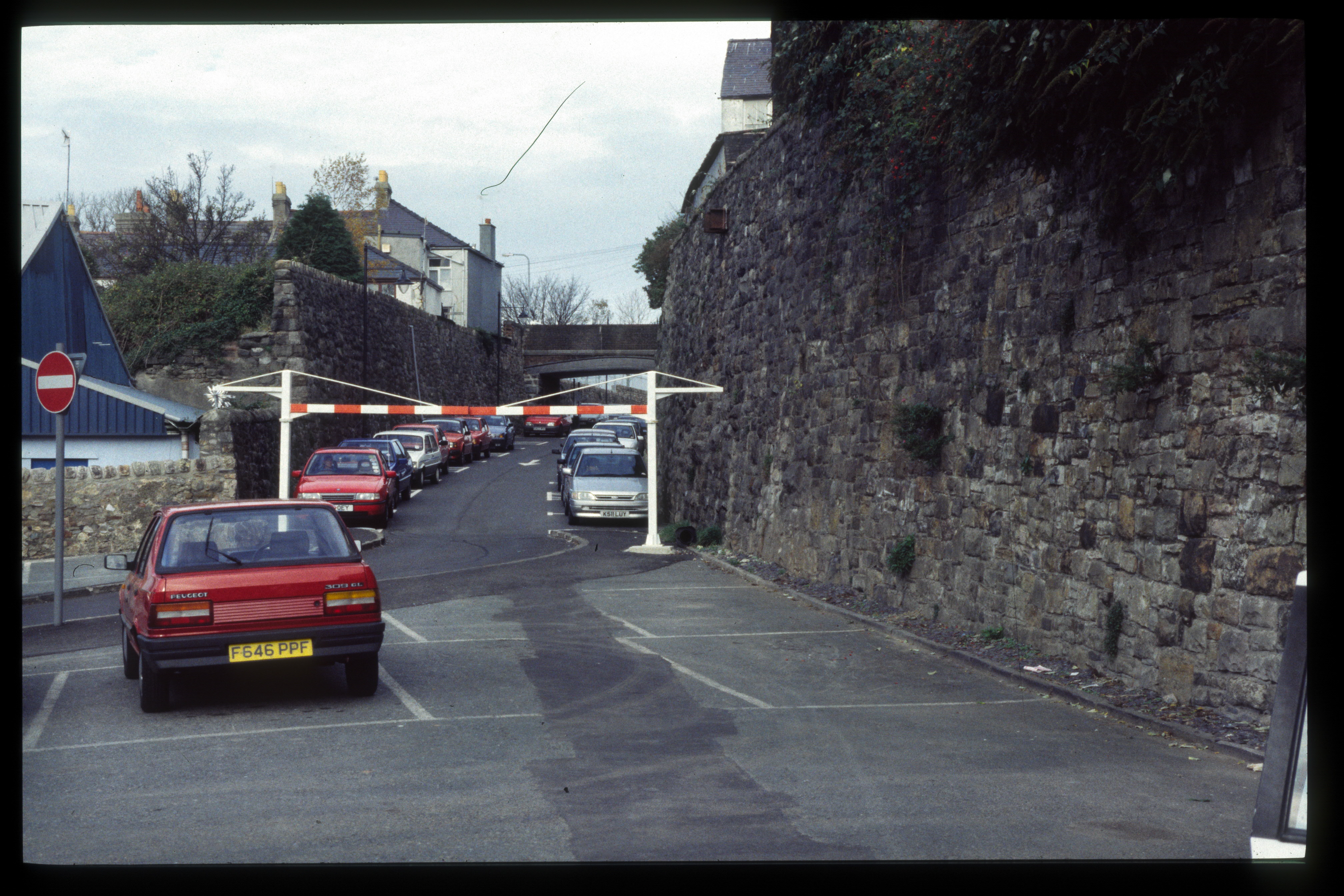
This easterly view (6?/11/95) shows the reverse angle of the Caernarfon Cross Town Link with the new road and car park on the incline up to the former Caernarfon BR station site. Image scanned from slide film by a Minolta DiMAGE Scan Dual III, Original image taken on an Sigma SA300 SLR camera copyright Barrie Hughes.
This northerly view (6?/11/95) shows the Dinas station site with a footpath crossing as seen from the road bridge in a similar position to the modern boarded crossing. Image scanned from slide film by a Minolta DiMAGE Scan Dual III, Original image taken on an Sigma SA300 SLR camera copyright Barrie Hughes.
This southerly view (6?/11/95) shows the Waunfawr station site from the road bridge. The twin tracks passed between the station building and the station master's house, now the Snowdonia Parc Brewpub. Image scanned from slide film by a Minolta DiMAGE Scan Dual III, Original image taken on an Sigma SA300 SLR camera copyright Barrie Hughes.
This southerly view (6?/11/95) shows the Afon Gwyrfai bridge at Betws Garmon. This bridge was replaced by an ex-BR bridge during Phase 2. Image scanned from slide film by a Minolta DiMAGE Scan Dual III, Original image taken on an Sigma SA300 SLR camera copyright Barrie Hughes.
This southerly view (6?/11/95) shows the Afon Gwyrfai bridge at Betws Garmon fenced off as it was dangerous. This bridge was replaced by an ex-BR bridge during Phase 2. Image scanned from slide film by a Minolta DiMAGE Scan Dual III, Original image taken on an Sigma SA300 SLR camera copyright Barrie Hughes.
This northerly view (6?/11/95) shows the embankment between the Betws Garmon Road bridge and the Afon Gwyrfai bridge. The Caernarfon Water main had been constructed on the trackbed after the route was closed and required moving to the right. Image scanned from slide film by a Minolta DiMAGE Scan Dual III, Original image taken on an Sigma SA300 SLR camera copyright Barrie Hughes.
This southerly view (6?/11/95) shows the site of Snowdon Ranger station. This bridge was replaced by an ex-BR bridge during Phase 2. The station building had unfortunately been sold off for holiday accommodation. Image scanned from slide film by a Minolta DiMAGE Scan Dual III, Original image taken on an Sigma SA300 SLR camera copyright Barrie Hughes.
This northerly view (6?/11/95) shows the f1ooded Castell Cidwm bridge The yellow courses of brickwork are typical of the NWNGR construction seen between Dinas and Pitt's Head road bridge. Image scanned from slide film by a Minolta DiMAGE Scan Dual III, Original image taken on an Sigma SA300 SLR camera copyright Barrie Hughes.
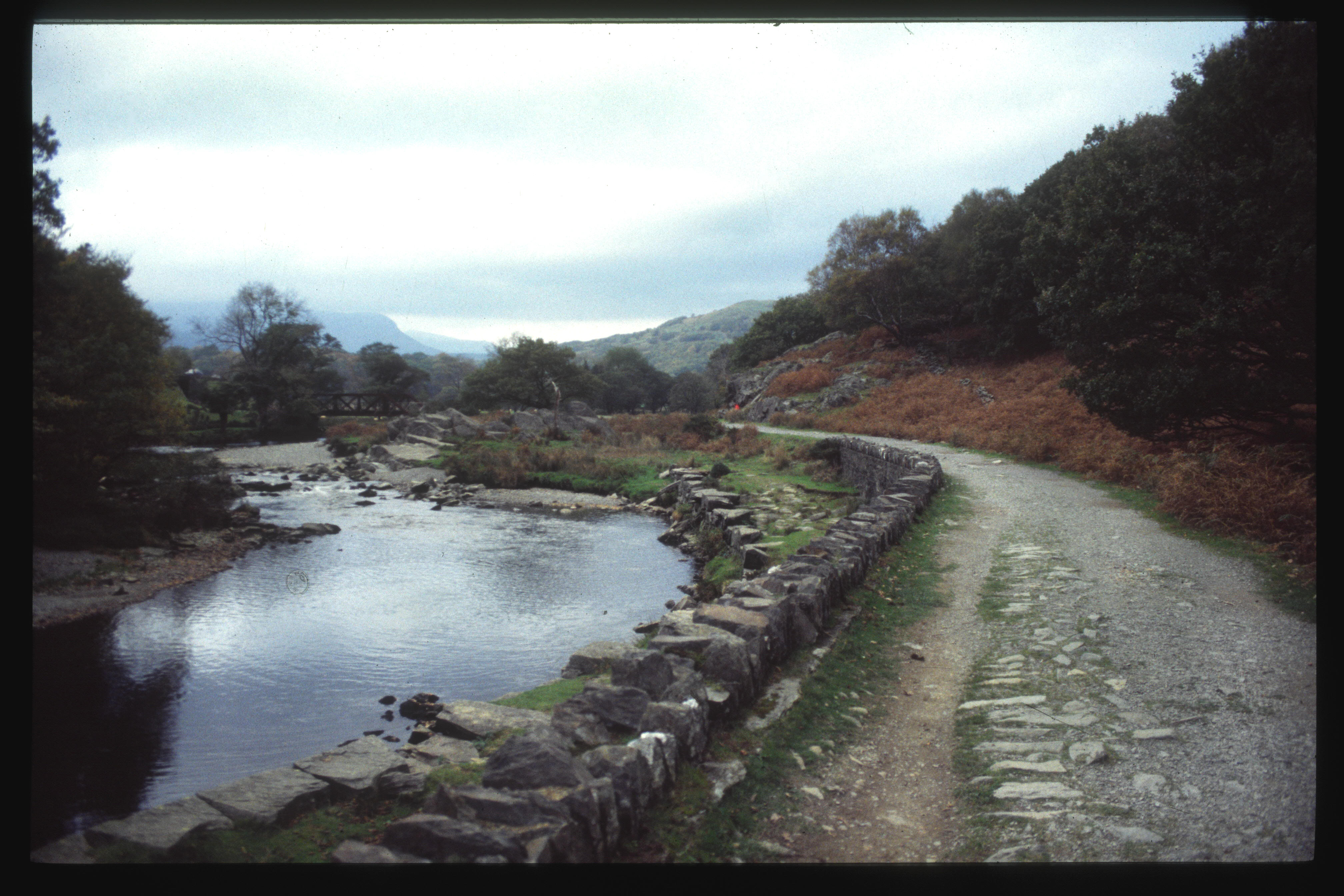
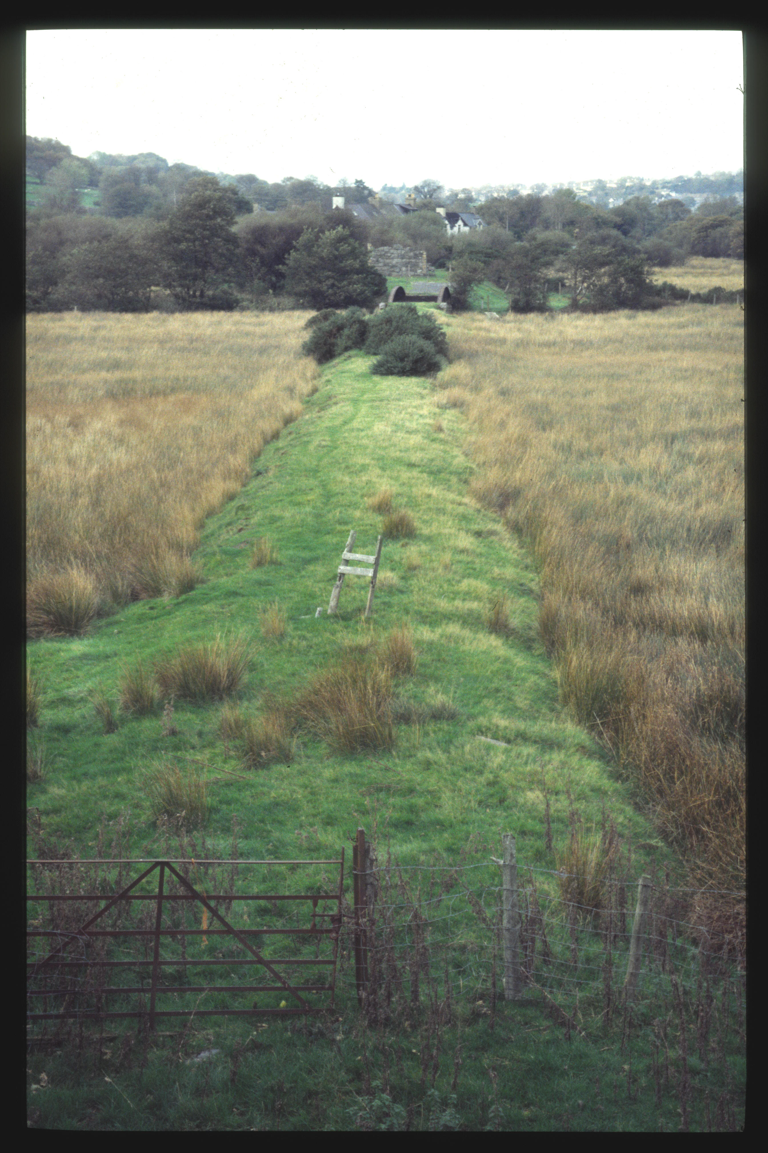
This northerly view (6?/11/95) shows the tracked just south of Bryn-y-felin bridge. Image scanned from slide film by a Minolta DiMAGE Scan Dual III, Original image taken on an Sigma SA300 SLR camera copyright Barrie Hughes.
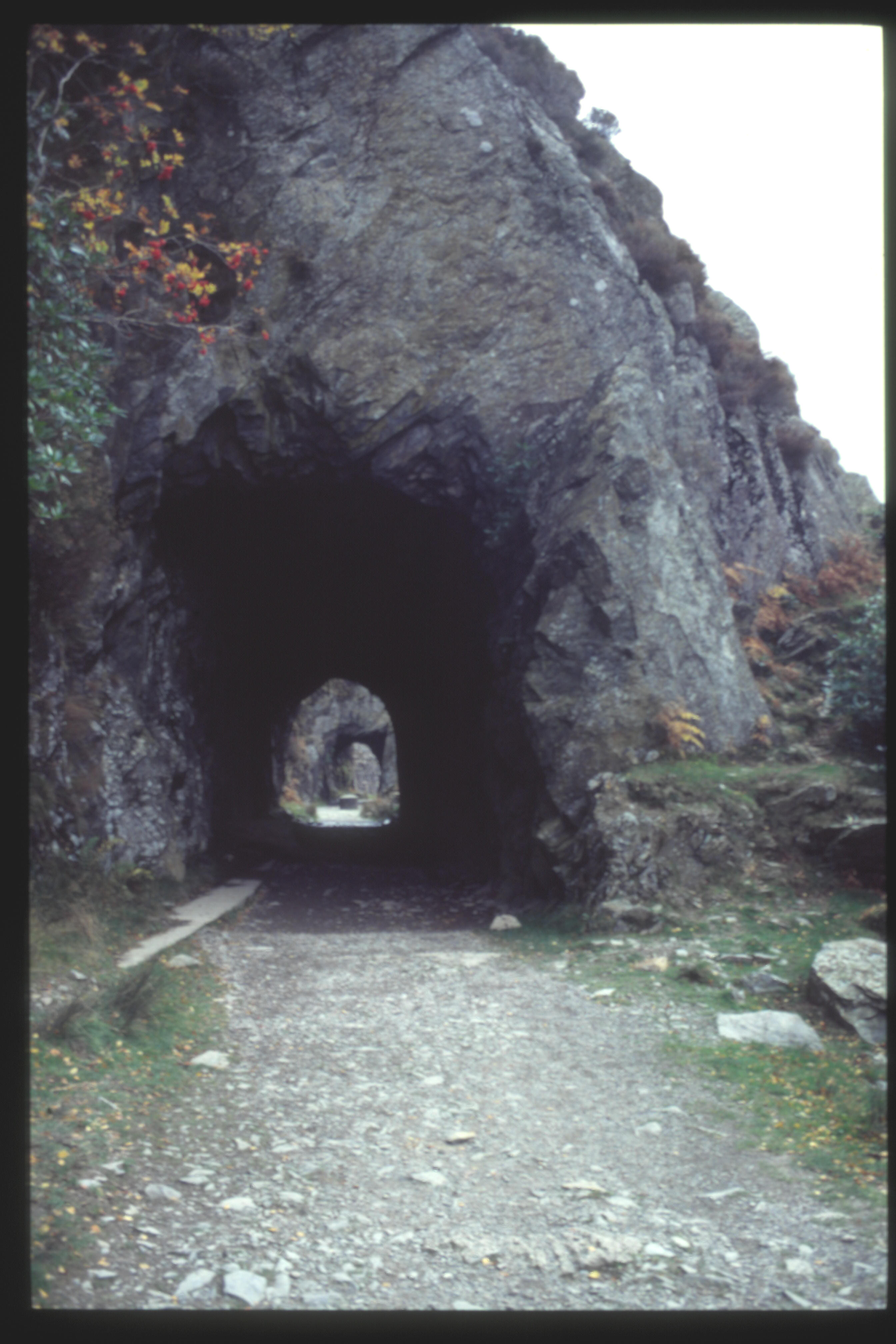
This southerly view (6?/11/95) shows the northern portal of the long Aberglaslyn Tunnel. The station building had unfortunately been sold off for holiday accommodation. Image scanned from slide film by a Minolta DiMAGE Scan Dual III, Original image taken on an Sigma SA300 SLR camera copyright Barrie Hughes.
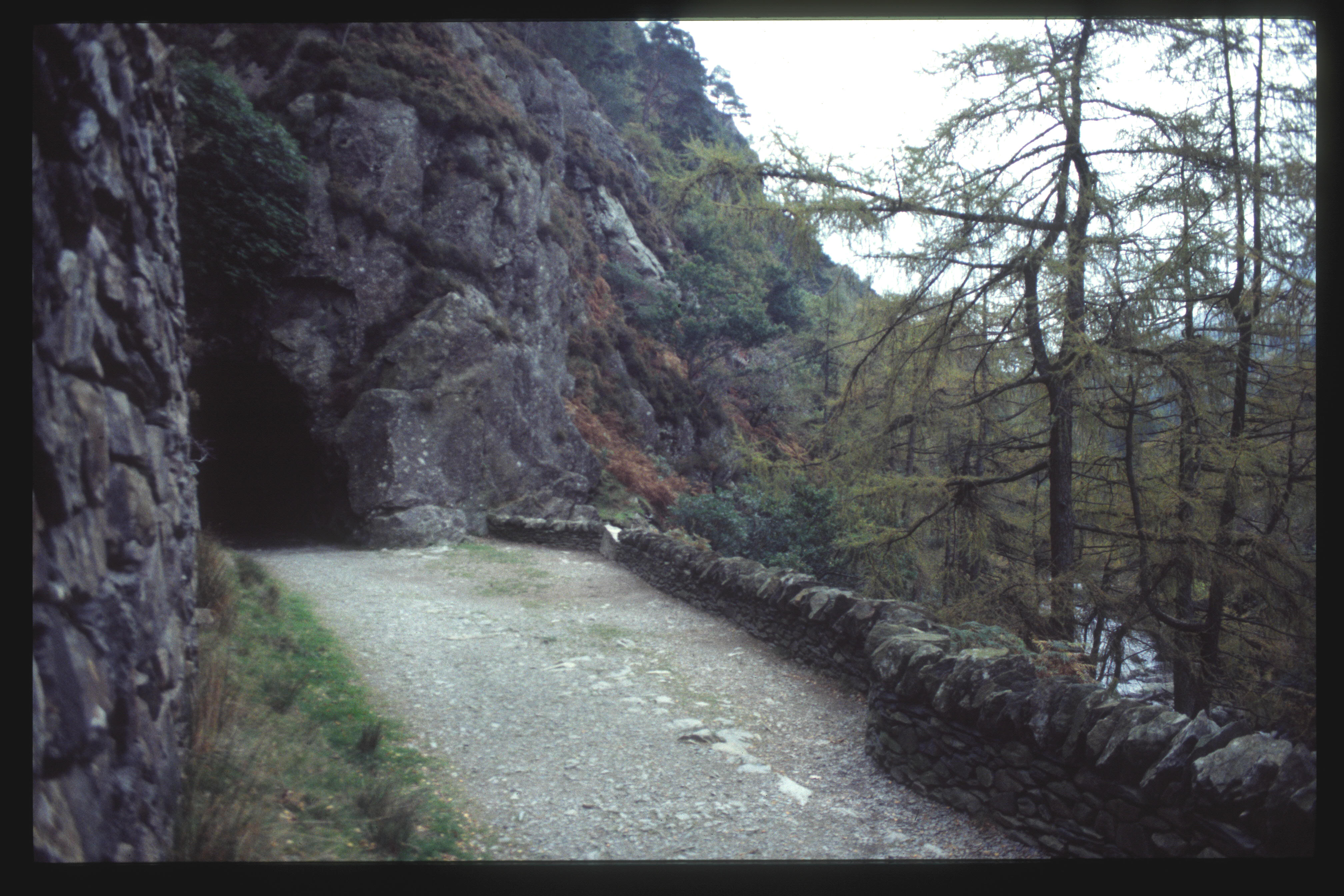
This southerly view (6?/11/95) shows the northern portal of the T2, looking through T3 towards the northern portal of T4, the long Aberglaslyn Tunnel. The Blacker Bombard mortar base can be seen between T3 and T4. This was designed to protect the area from a potential German invasion of Wales from the west, assuming they occupied Ireland. Image scanned from slide film by a Minolta DiMAGE Scan Dual III, Original image taken on an Sigma SA300 SLR camera copyright Barrie Hughes.
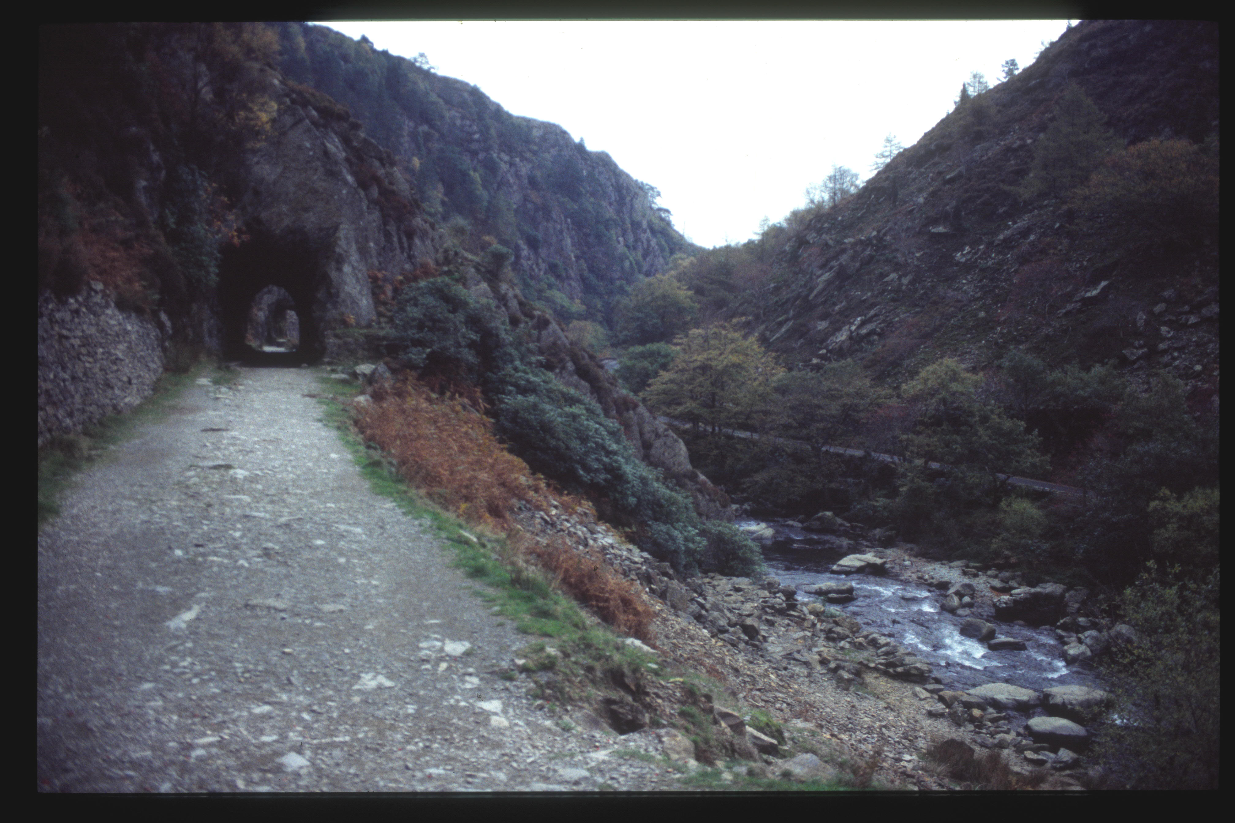
This southerly view (6?/11/95) shows the northern portal of the T2,in relation to the Afon Glaslyn. The tunnels were eventually closed off for H&S reasons when the FR took ownership. Image scanned from slide film by a Minolta DiMAGE Scan Dual III, Original image taken on an Sigma SA300 SLR camera copyright Barrie Hughes.
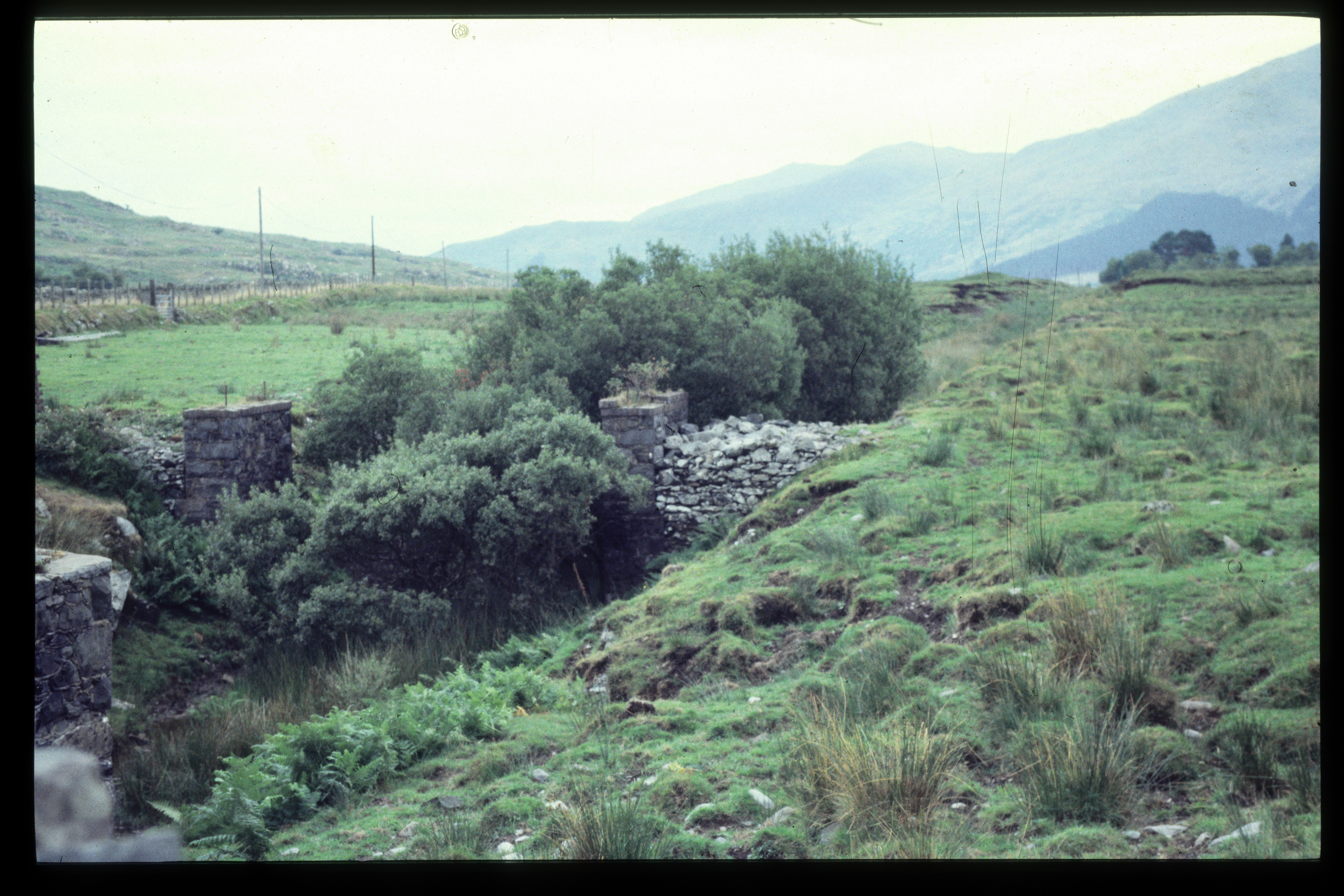
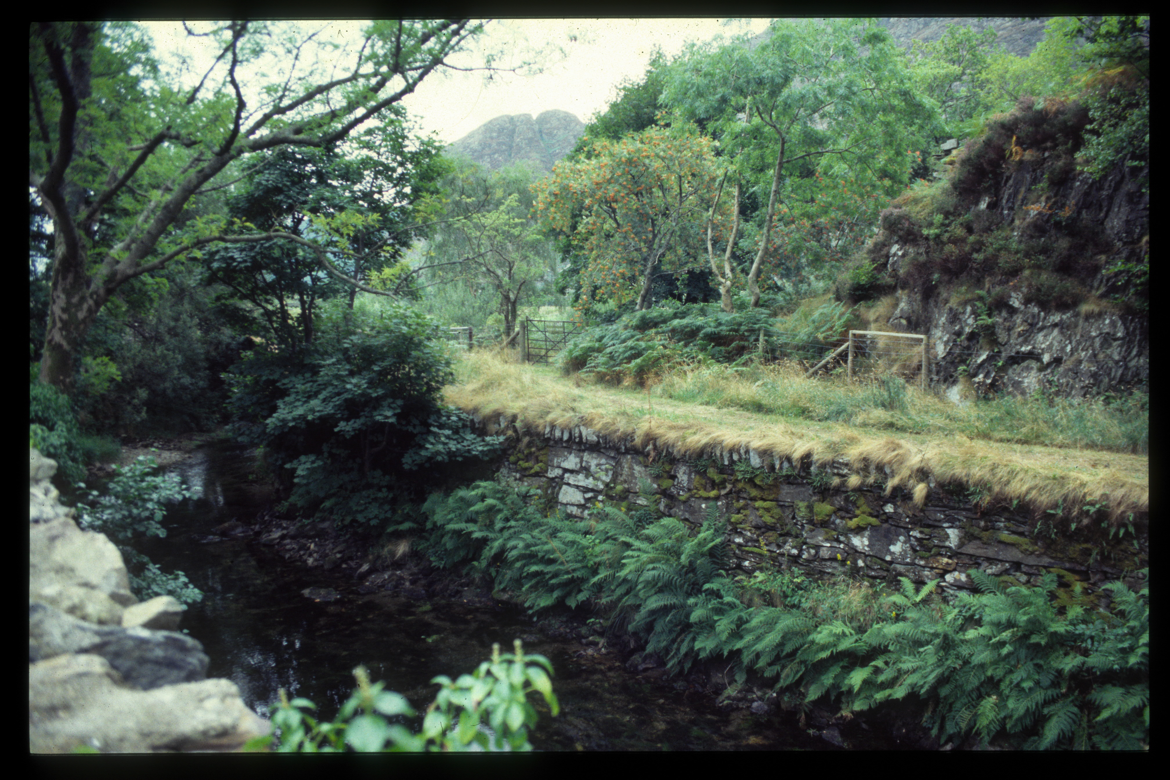
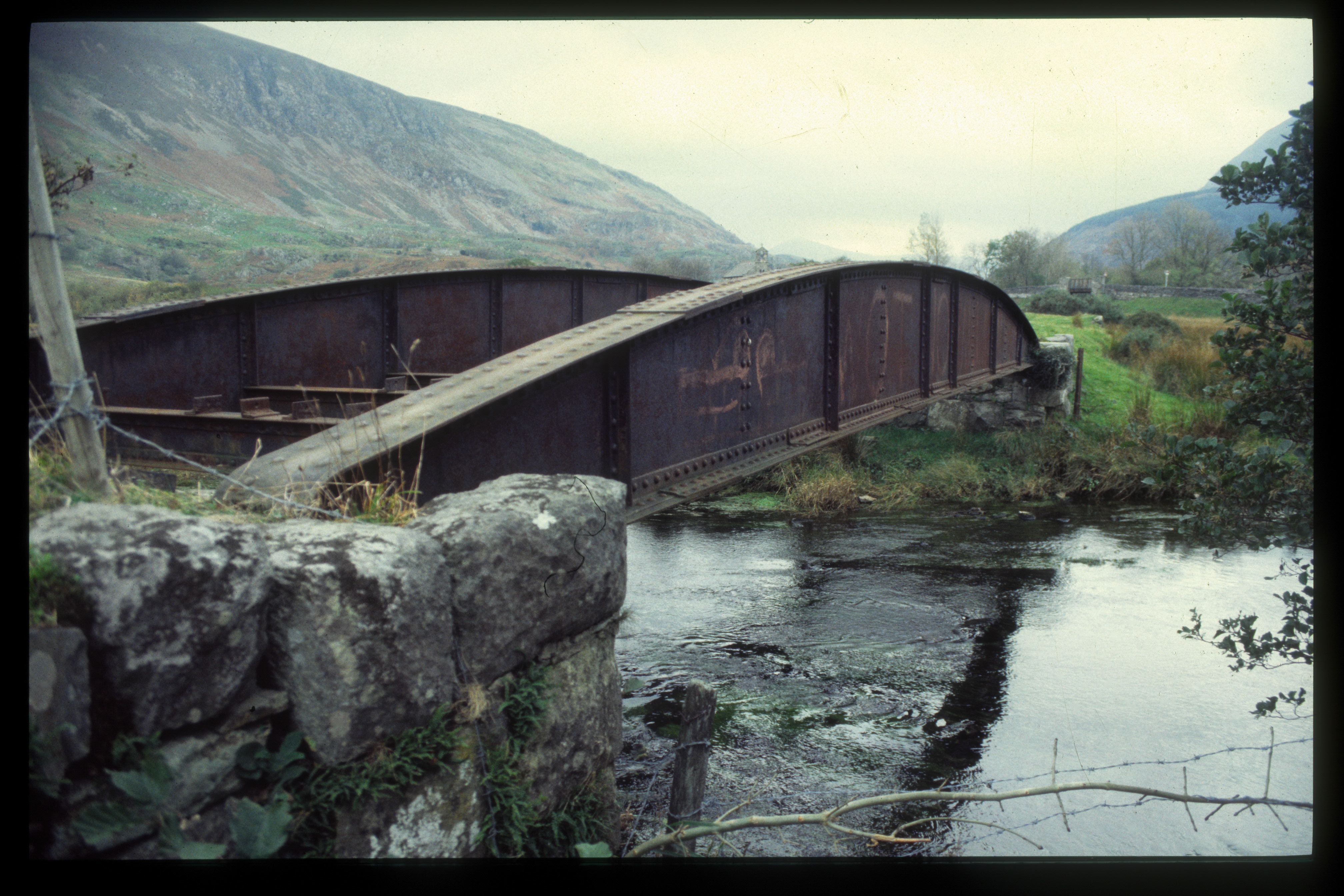
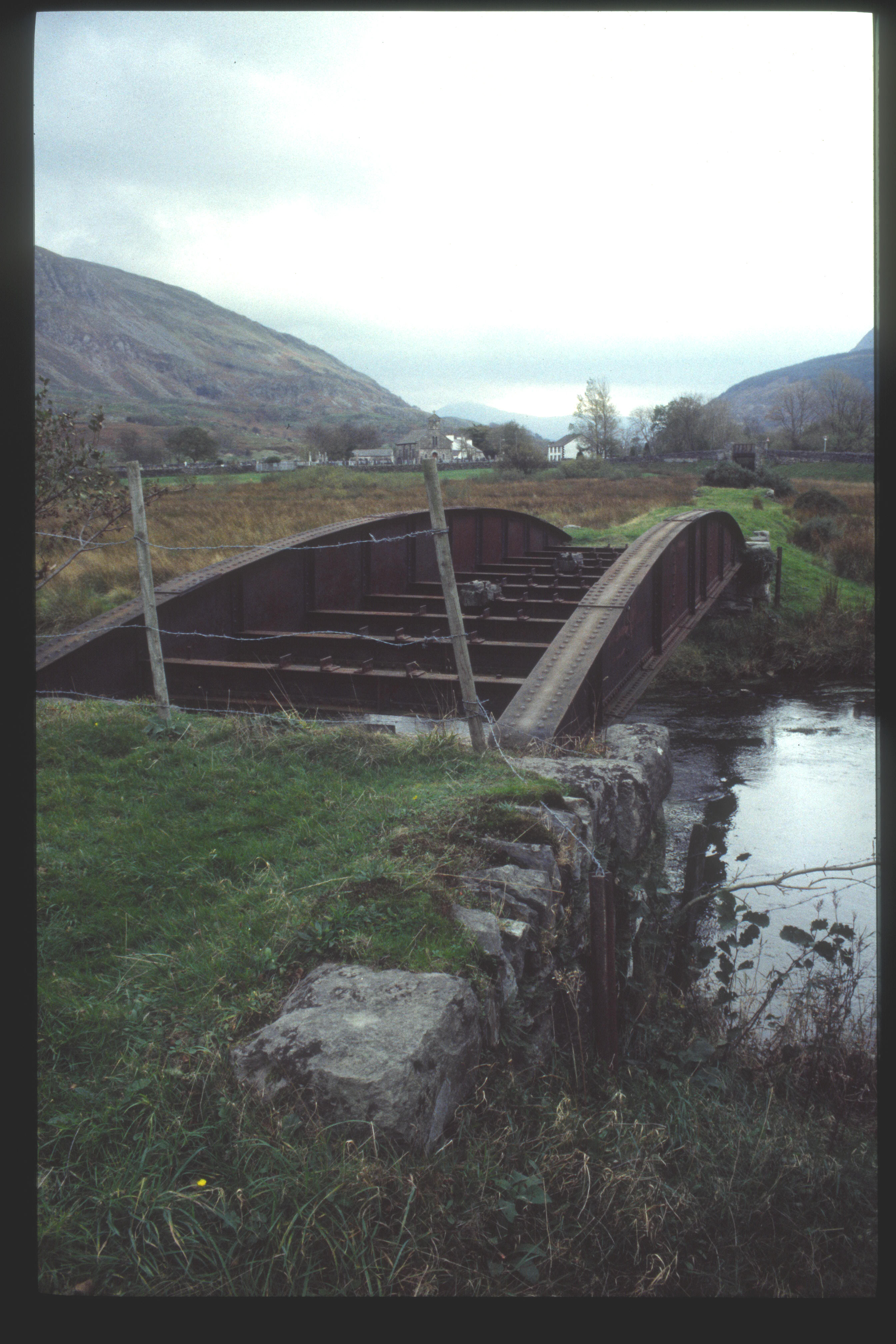
This northerly view (6?/11/95) shows the missing bridge at Pont Croesor. GC had recently upgraded the road bridge at this location as shown by the new concrete. Image scanned from slide film by a Minolta DiMAGE Scan Dual III, Original image taken on an Sigma SA300 SLR camera copyright Barrie Hughes.
18/11/95
With the FR buying the WHR route with its wider structure gauge a use could now be found for K1 which was too big for the FR. The Birmingham Railway Museum at Tyseley had granted K1 some space around the turntable. The location was also nearer a team of Midlands engineers who could start work on the project than Boston Lodge.
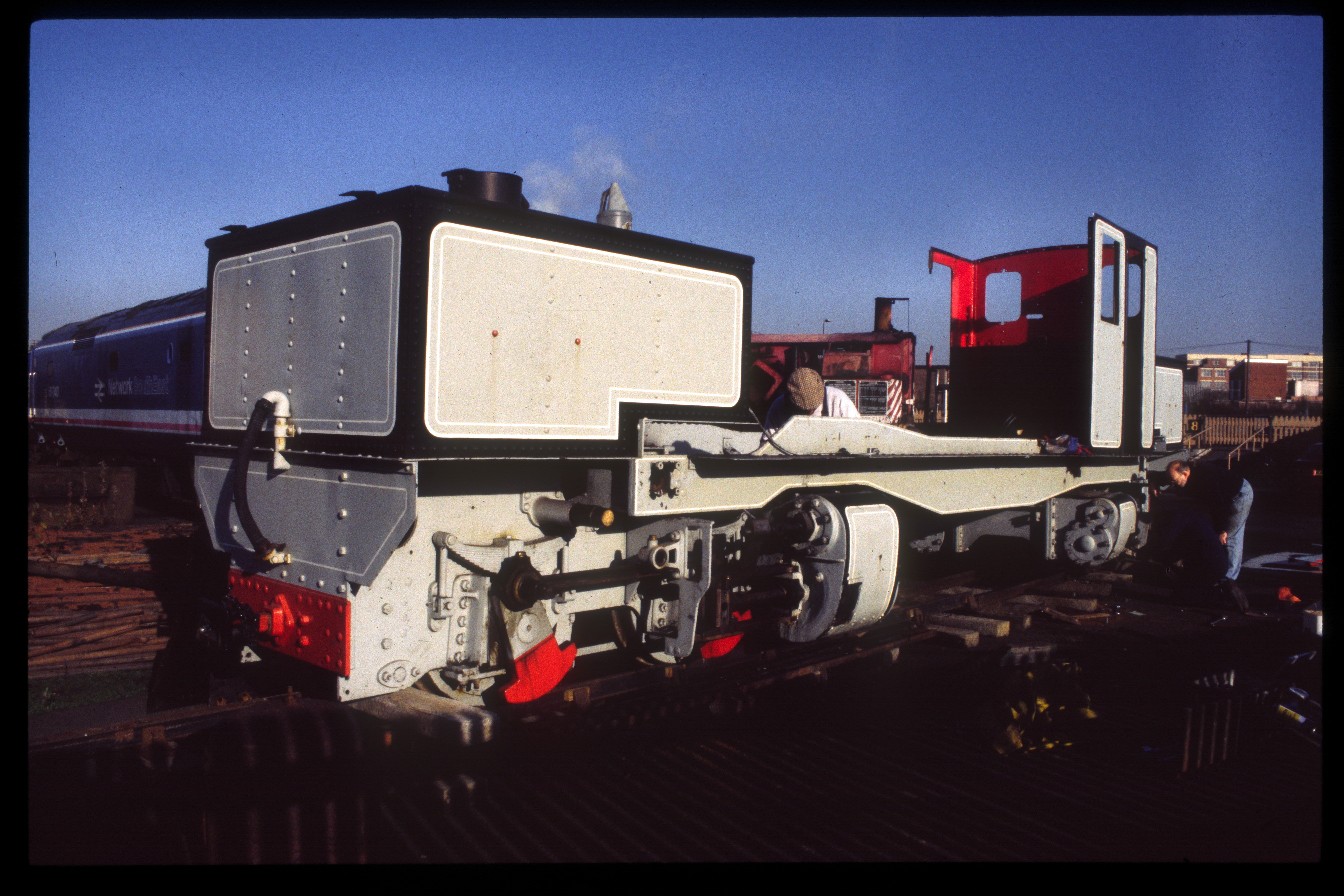
This Tyseley view (18/11/95) shows the disassembly of K1 prior to refurbishment of the loco. Image scanned from slide film by a Minolta DiMAGE Scan Dual III, Original image taken on an Sigma SA300 SLR camera copyright Barrie Hughes.
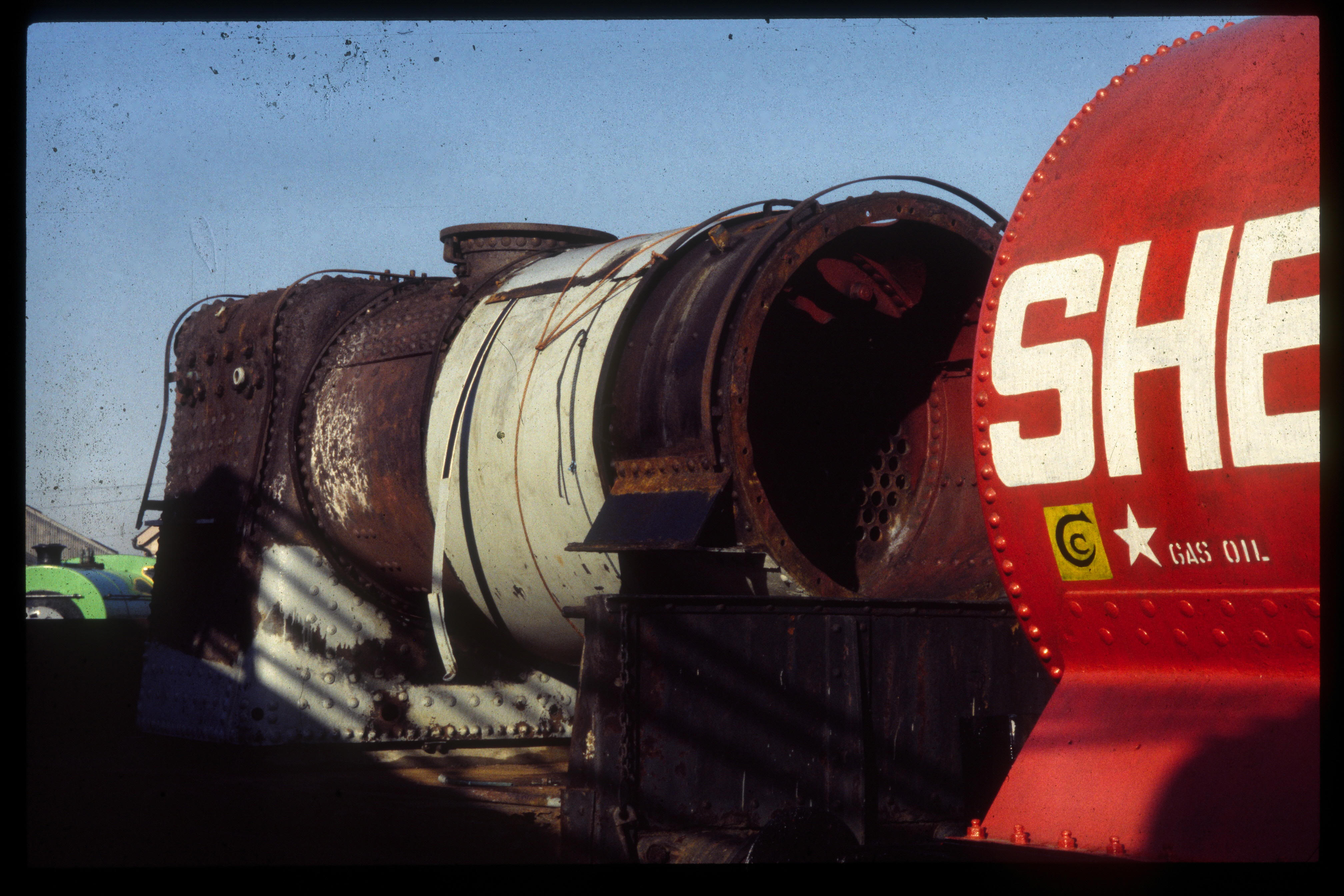
This Tyseley view (18/11/95) shows the boiler of K1 with cladding removal. Image scanned from slide film by a Minolta DiMAGE Scan Dual III, Original image taken on an Sigma SA300 SLR camera copyright Barrie Hughes.
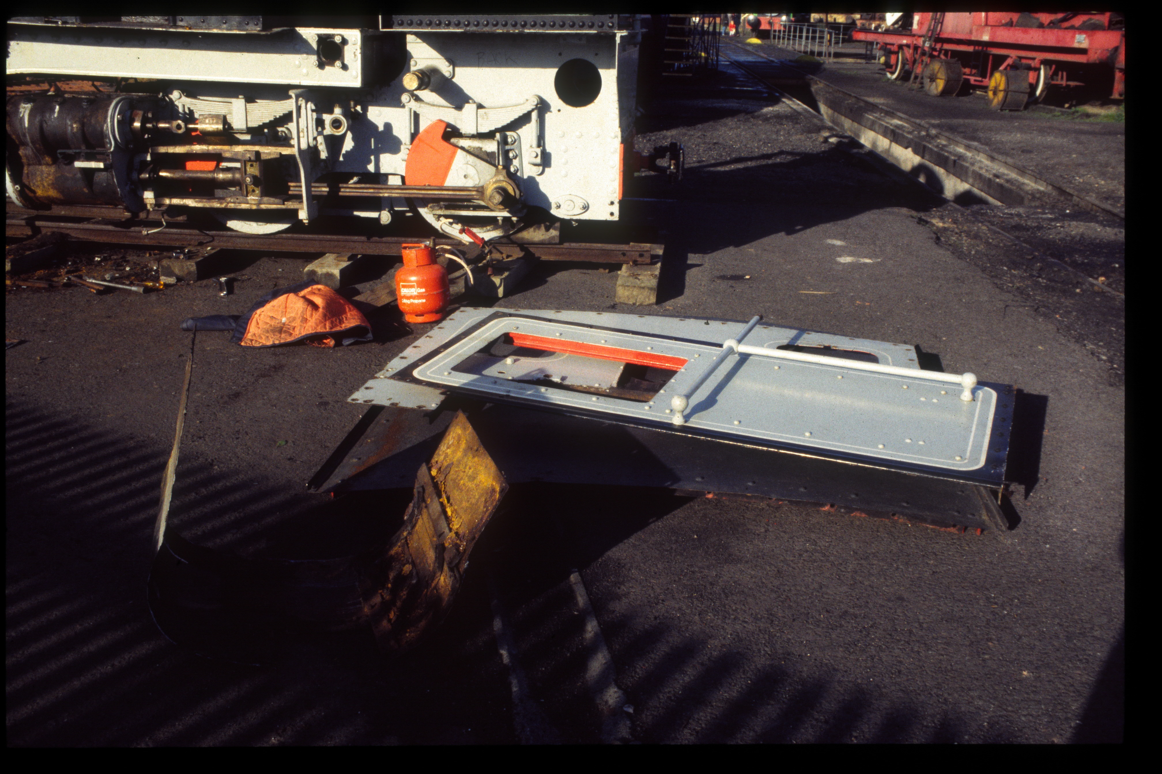
This Tyseley view (18/11/95) shows cabside parts of K1 lying around the turntable. Image scanned from slide film by a Minolta DiMAGE Scan Dual III, Original image taken on an Sigma SA300 SLR camera copyright Barrie Hughes.
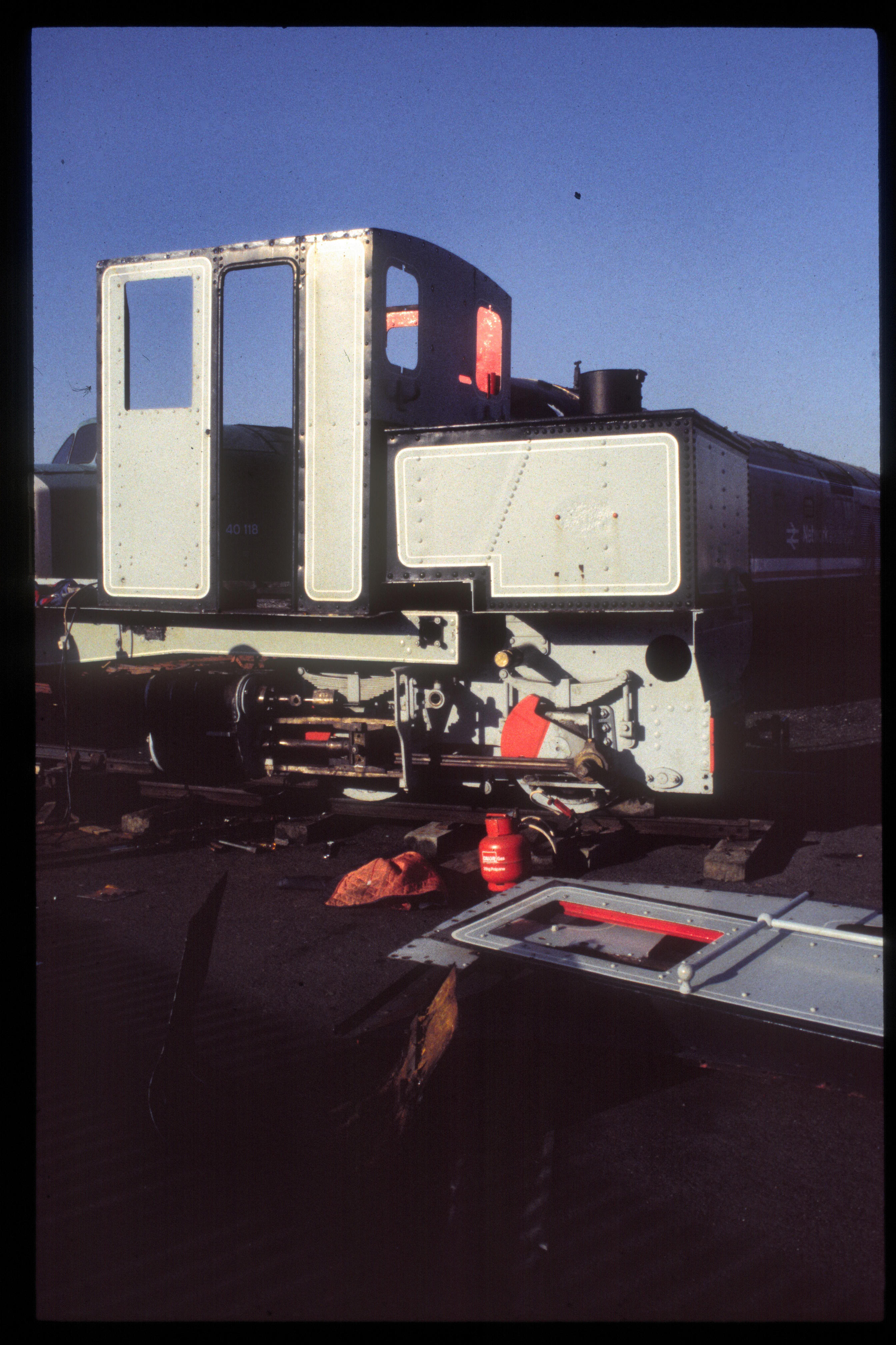
This Tyseley view (18/11/95) shows a rear view of K1. Image scanned from slide film by a Minolta DiMAGE Scan Dual III, Original image taken on an Sigma SA300 SLR camera copyright Barrie Hughes.
5?/4/96
I had a few days in North Wales visiting the Llangollen Railway and the FR/WHR over the Bank Holiday Weekend.
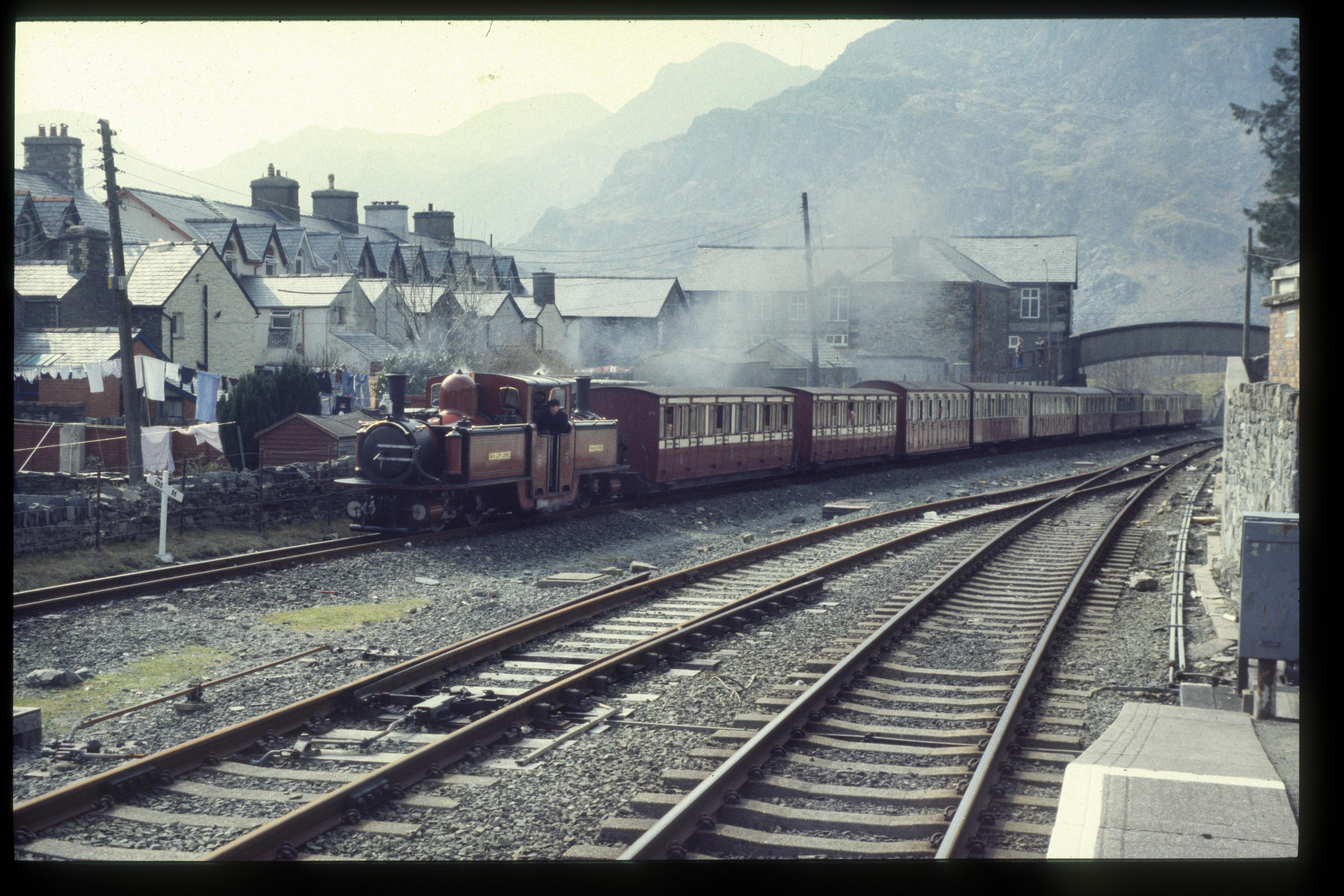
This westerly view (5?/4/96) shows David Lloyd George arriving at Blaenau Ffestiniog from the BR platform. This loco was built as long ago as 1992 to the traditional Spooner design but was oil fired and ran initially on old power bogies. Image scanned from slide film by a Minolta DiMAGE Scan Dual III, Original image taken on an Sigma SA300 SLR camera copyright Barrie Hughes.
This westerly view (5?/4/96) shows David Lloyd George departing Blaenau Ffestiniog from the BR platform. The loco was one of the main stalwarts of the fleet for a decade until withdrawn for a rebuild in 2002. Image scanned from slide film by a Minolta DiMAGE Scan Dual III, Original image taken on an Sigma SA300 SLR camera copyright Barrie Hughes.
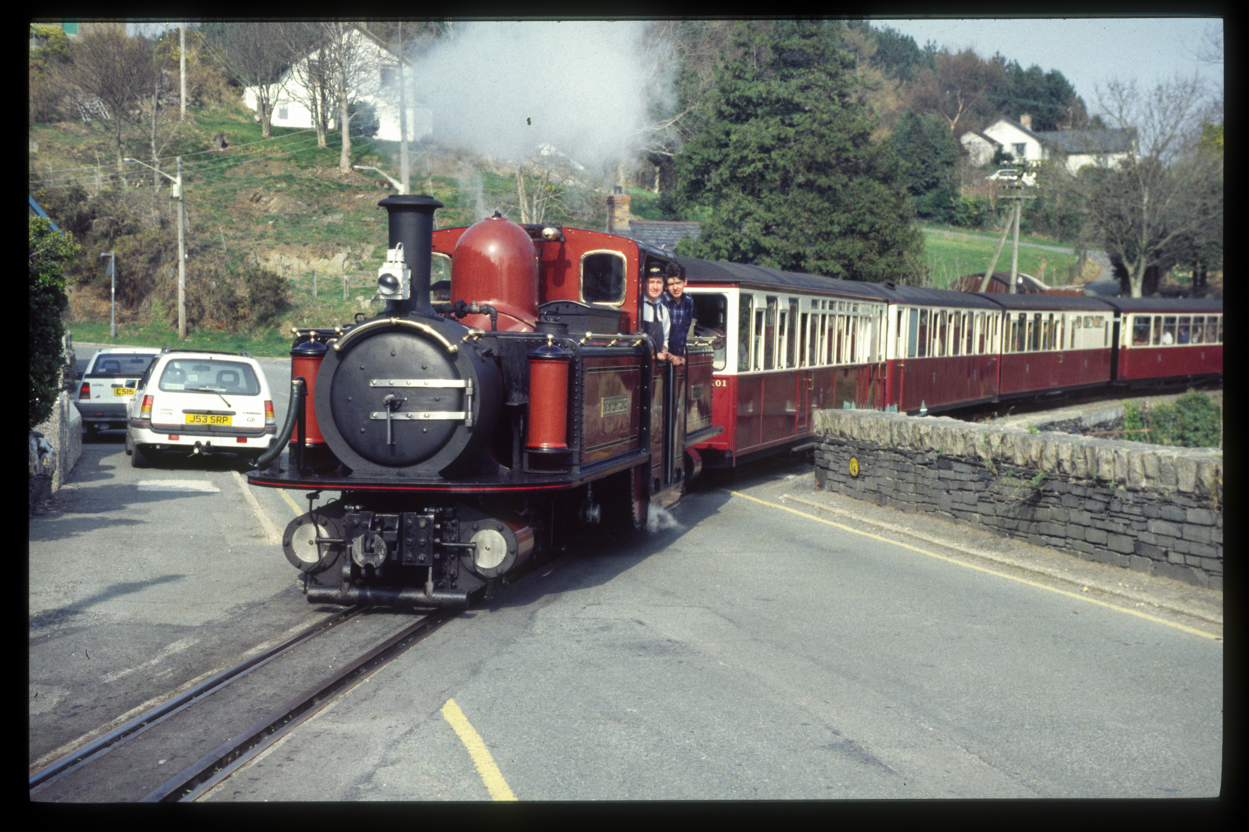
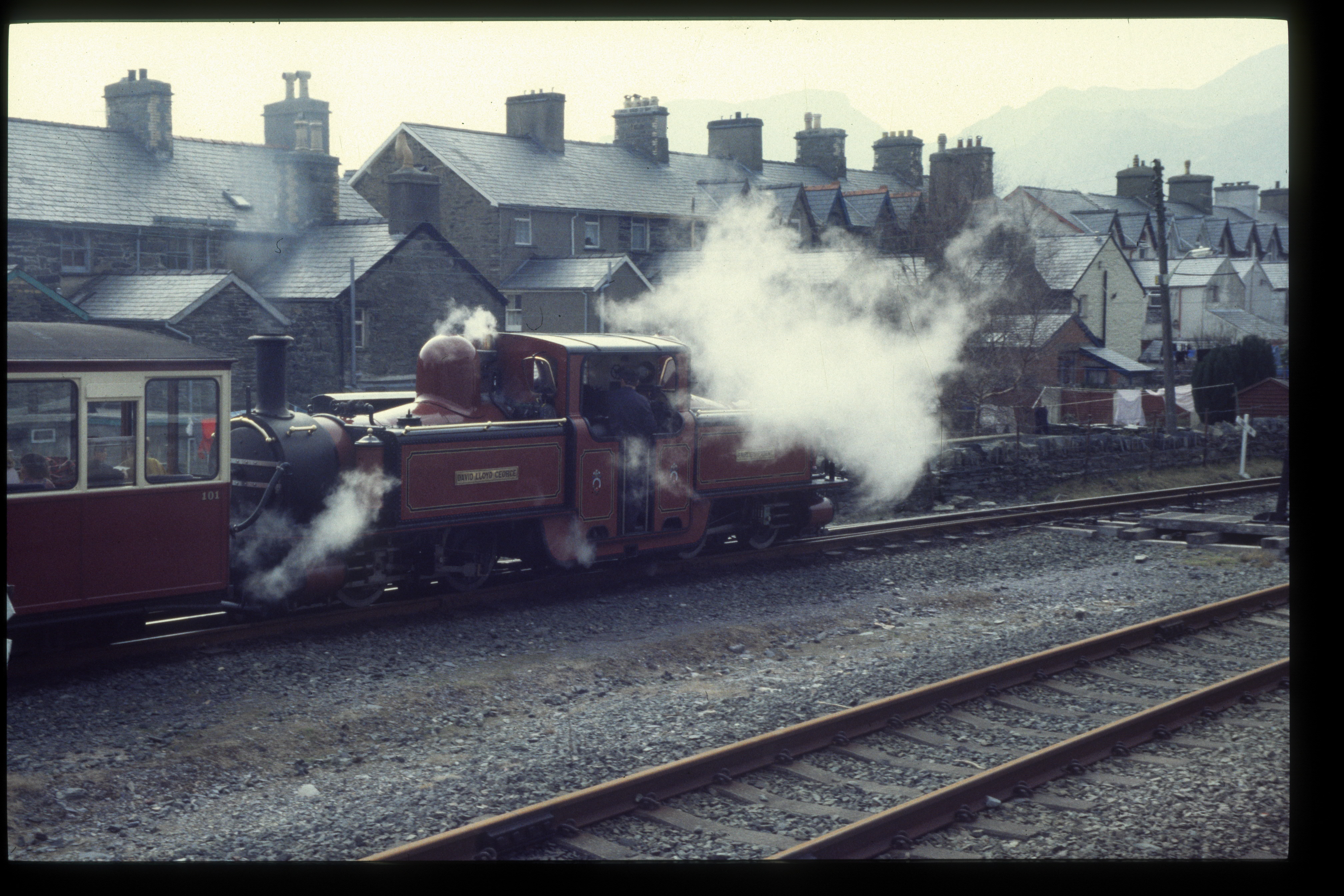
This easterly view (5?/4/96) shows David Lloyd George at Penrhyndeudraeth Level Crossing. The loco has always sported its bright red livery except for a short period in grey undercoat around 2014. Image scanned from slide film by a Minolta DiMAGE Scan Dual III, Original image taken on an Sigma SA300 SLR camera copyright Barrie Hughes.
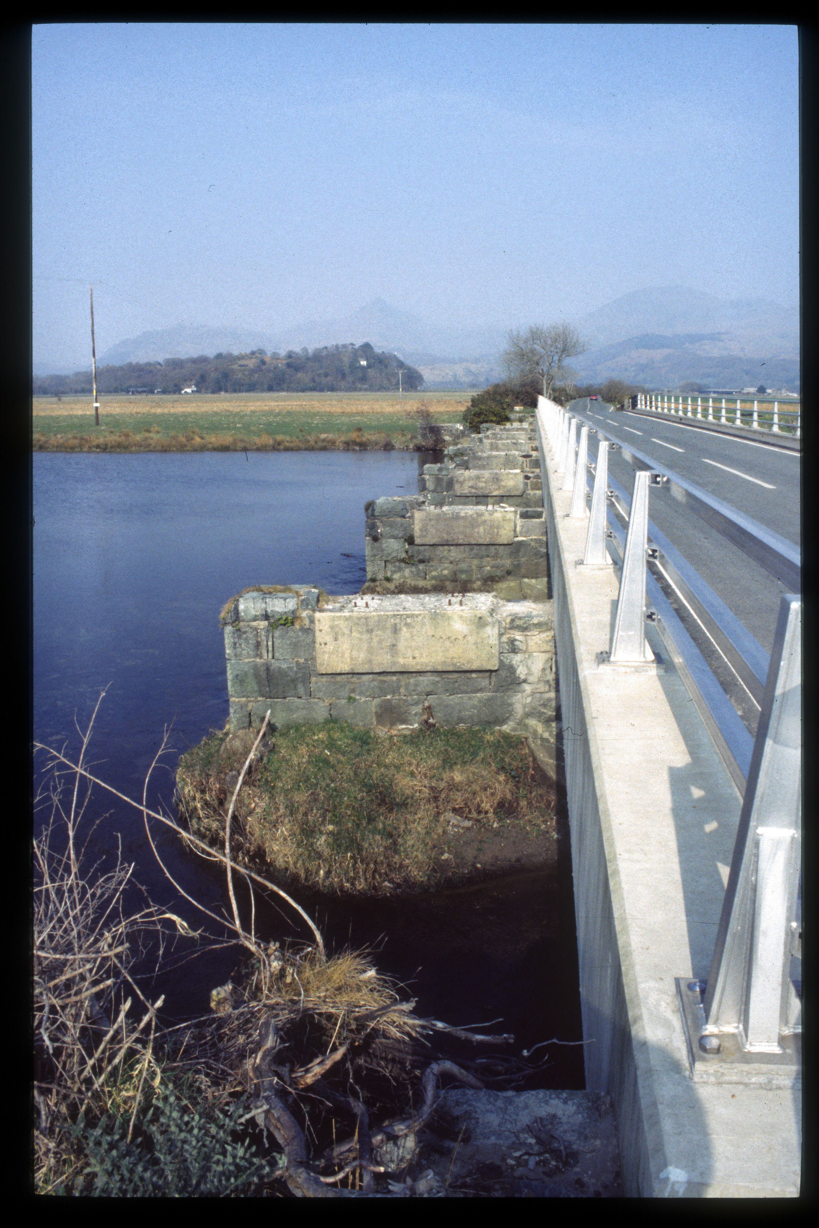
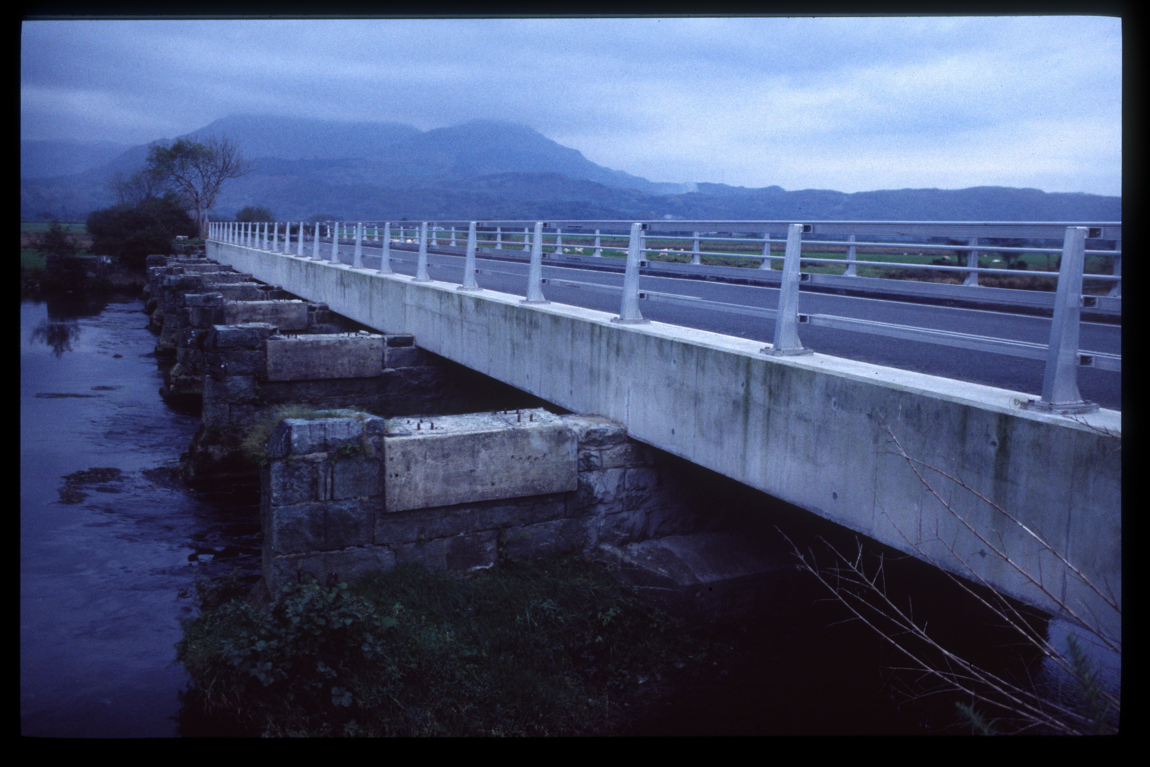
This northerly view (5?/4/96) shows Pont Croesor. The GC upgrade of the road deck had been made with the knowledge that the WHR was being rebuilt but had left a narrow space on the top of the piers to bear the railway bridge. A full width rail bridge with a walkway was achieved by an asymmetric design with the walkway cantilevered over the west side of the bridge. Image scanned from slide film by a Minolta DiMAGE Scan Dual III, Original image taken on an Sigma SA300 SLR camera copyright Barrie Hughes.
Click here to return to Stop Press page
V4.6 updated 9/9/23